Approximate Location Map
Large Map »
Latitude: 51.5284 / 51°31'42"N
Longitude: -0.0134 / 0°0'48"W
OS Eastings: 537902
OS Northings: 182919
OS Grid: TQ379829
Mapcode National: GBR KY.F8W
Mapcode Global: VHGQV.QV87
Plus Code: 9C3XGXHP+8J
Entry Name: How Memorial Gateway
Listing Date: 27 September 1973
Grade: II
Source: Historic England
Source ID: 1065281
English Heritage Legacy ID: 205800
ID on this website: 101065281
Location: St Lenoard's Priory, Bromley, Tower Hamlets, London, E3
County: London
District: Tower Hamlets
Electoral Ward/Division: Bromley North
Parish: Non Civil Parish
Built-Up Area: Tower Hamlets
Traditional County: Middlesex
Lieutenancy Area (Ceremonial County): Greater London
Church of England Parish: St Mary Bow and Holy Trinity
Church of England Diocese: London
Tagged with: Building
BROMLEY HIGH STREET E3
1.
443l
(South Side)
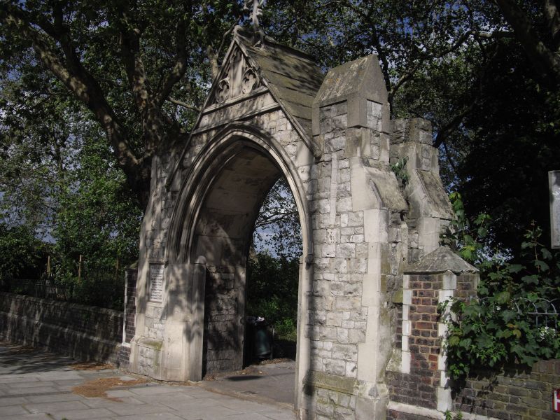
How Memorial Gateway
TQ 3782 12/280
II
2.
Circa 1893. Gabled stone gothic arch with double buttresses at each side. Formerly
an entrance to St Mary's Churchyard.
Listing NGR: TQ3790282919
External links are from the relevant listing authority and, where applicable, Wikidata. Wikidata IDs may be related buildings as well as this specific building. If you want to add or update a link, you will need to do so by editing the Wikidata entry.


Other nearby listed buildings
