Latitude: 51.3657 / 51°21'56"N
Longitude: -0.1672 / 0°10'1"W
OS Eastings: 527691
OS Northings: 164549
OS Grid: TQ276645
Mapcode National: GBR DD.QKC
Mapcode Global: VHGRK.1XZZ
Plus Code: 9C3X9R8M+74
Entry Name: 3, West Street
Listing Date: 1 March 1974
Grade: II
Source: Historic England
Source ID: 1065634
English Heritage Legacy ID: 206807
ID on this website: 101065634
Location: Carshalton, Sutton, London, SM5
County: London
District: Sutton
Electoral Ward/Division: Carshalton Central
Parish: Non Civil Parish
Built-Up Area: Sutton
Traditional County: Surrey
Lieutenancy Area (Ceremonial County): Greater London
Church of England Parish: Carshalton All Saints
Church of England Diocese: Southwark
Tagged with: Building
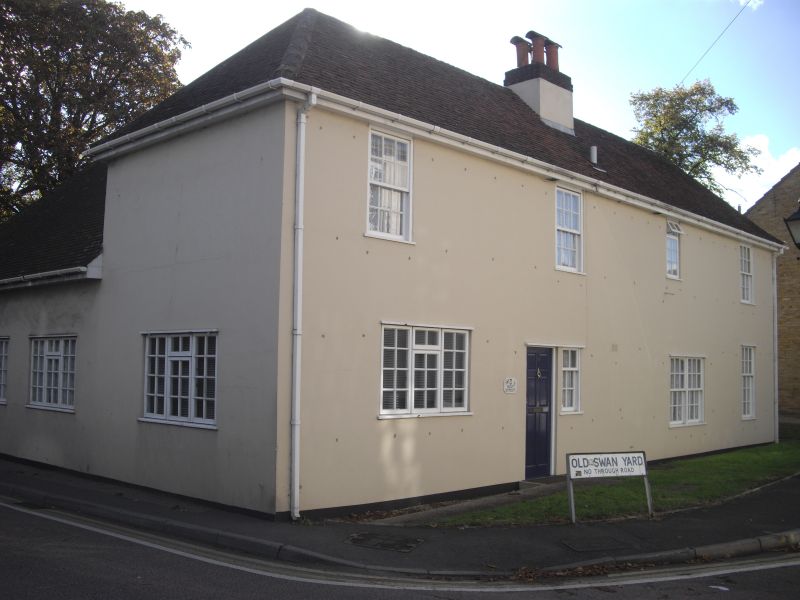
WEST STREET 1. 4430 (West Side) CARSHALTON No 3 TQ 2764 NE 18/182 II GV 2. Circa 1786. Formerly the Swan Inn. There is an entry in the Manorial Court Records for 1786 which refers to the demolition and rebuilding of the Inn. 2 storeys. Hipped old tile roof. Red brick walls with east wall and part of north wall rendered. In east front to street, one modern 3-light window on ground floor. In north front, modern wood casements above. Ground floor front wall remains intact behind light modern workshop addition; from left to right hand, a 3-light sash, a door, a small sash window, a 6-flush-panelled door, a further door and a window.
The Water Pavilion at Carshalton House and boundary wall to Carshalton House in West Street form a group with Nos 3 to 11 (odd) and No l5 West Street with Nos 2 to 12 and 18 to 24 (even) West Street and with The old Rectory, Festival Walk.
Listing NGR: TQ2769164549
External links are from the relevant listing authority and, where applicable, Wikidata. Wikidata IDs may be related buildings as well as this specific building. If you want to add or update a link, you will need to do so by editing the Wikidata entry.


Other nearby listed buildings