Latitude: 51.5054 / 51°30'19"N
Longitude: -0.1335 / 0°8'0"W
OS Eastings: 529637
OS Northings: 180152
OS Grid: TQ296801
Mapcode National: GBR GG.5J
Mapcode Global: VHGQZ.MFS8
Plus Code: 9C3XGV48+5H
Entry Name: 3, Carlton Gardens SW1
Listing Date: 9 January 1970
Grade: II*
Source: Historic England
Source ID: 1066349
English Heritage Legacy ID: 208973
ID on this website: 101066349
Location: Whitehall, Westminster, London, SW1Y
County: London
District: City of Westminster
Electoral Ward/Division: St James's
Parish: Non Civil Parish
Built-Up Area: City of Westminster
Traditional County: Middlesex
Lieutenancy Area (Ceremonial County): Greater London
Church of England Parish: St Martin-in-the-Fields
Church of England Diocese: London
TQ 2980 SE CITY OF WESTMINSTER CARLTON GARDENS, SW1 82/81 9.1.70 No. 3
G.V. II*
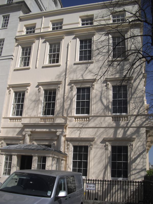
Originally one of a pair of large town houses. c.1828 by Decimus Burton. Stucco, slate roofs. Part of the southern termination of Nash's Via Triumphalis, raised on the continuation of the terrace carrying Carlton House Terrace facing the Mall. 3 storeys and attic storey, with basement and low dormered mansard. 4 windows wide. Entrance to left under portico-porch with 2 pairs of Ionic columns and balustraded parapet. Recessed glazing bar sashes in shallow architraves with cornices on consoles to ground and 1st floors. Dentil cornice over 2nd floor. Cornice and blocking course to attic. 1st floor windows have blind balustrading below window sills. 5 window wide return facing park with similar details and in addition a fully developed balustraded 1st floor balcony on shallow console brackets. Cast iron spear head area railings.
Survey of London; Vol. XX.
Listing NGR: TQ2963780152
External links are from the relevant listing authority and, where applicable, Wikidata. Wikidata IDs may be related buildings as well as this specific building. If you want to add or update a link, you will need to do so by editing the Wikidata entry.


Other nearby listed buildings