Approximate Location Map
Large Map »
Latitude: 51.4883 / 51°29'17"N
Longitude: -0.1747 / 0°10'29"W
OS Eastings: 526824
OS Northings: 178170
OS Grid: TQ268781
Mapcode National: GBR 4N.YN
Mapcode Global: VHGQY.XVHG
Plus Code: 9C3XFRQG+84
Entry Name: Forecourt Wall to Sloane House
Listing Date: 7 November 1984
Grade: II
Source: Historic England
Source ID: 1066604
English Heritage Legacy ID: 422345
ID on this website: 101066604
Location: Chelsea, Kensington and Chelsea, London, SW3
County: London
District: Kensington and Chelsea
Electoral Ward/Division: Stanley
Parish: Non Civil Parish
Built-Up Area: Kensington and Chelsea
Traditional County: Middlesex
Lieutenancy Area (Ceremonial County): Greater London
Church of England Parish: Chelsea St John with St Andrew
Church of England Diocese: London
Tagged with: Wall
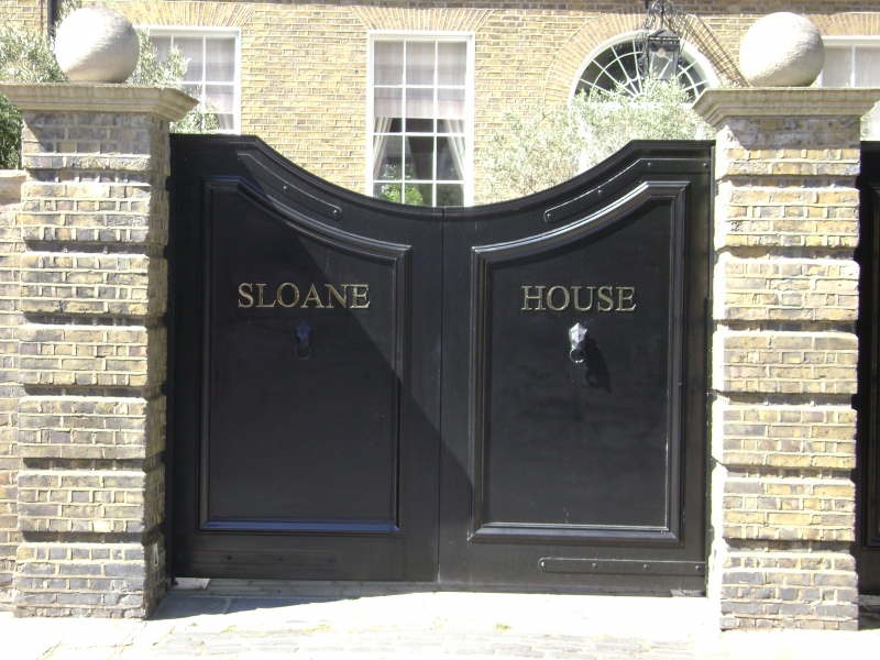
TQ 2678 SE OLD CHURCH STREET SW3
55/38
Forecourt wall to Sloane
House
GV
II
Late C18. Brick forecourt wall with stone capped rusticated piers.
Listing NGR: TQ2682478170
External links are from the relevant listing authority and, where applicable, Wikidata. Wikidata IDs may be related buildings as well as this specific building. If you want to add or update a link, you will need to do so by editing the Wikidata entry.


Other nearby listed buildings
