Latitude: 51.4971 / 51°29'49"N
Longitude: -0.1277 / 0°7'39"W
OS Eastings: 530061
OS Northings: 179236
OS Grid: TQ300792
Mapcode National: GBR HK.HH
Mapcode Global: VHGQZ.QMTP
Plus Code: 9C3XFVWC+RW
Entry Name: 18, Cowley Street SW1
Listing Date: 24 February 1958
Grade: II*
Source: Historic England
Source ID: 1066953
English Heritage Legacy ID: 209350
ID on this website: 101066953
Location: Westminster, London, SW1P
County: London
District: City of Westminster
Electoral Ward/Division: St James's
Parish: Non Civil Parish
Built-Up Area: City of Westminster
Traditional County: Middlesex
Lieutenancy Area (Ceremonial County): Greater London
Church of England Parish: St Matthew Westminster
Church of England Diocese: London
Tagged with: Building
TQ 3079 SW CITY OF WESTMINSTER COWLEY STREET, SW1 101/49 24.2.58 No. 18
G.V. II*
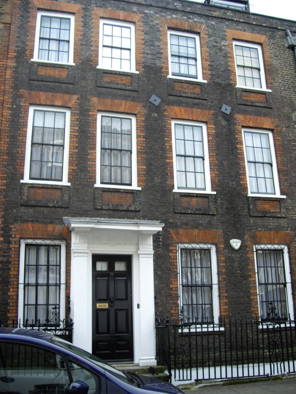
Terrace house. c.1722. Brown brick, tiled roof. 3 storeys, basement and dormered mansard. 4 windows wide. Entrance in 2nd bay from left with early C.18 doorcase of Doric pilasters with entablature of same order with slight break and soffit panels to the cornice-hood. Recessed glazing bar sashes under flat gauged rubbed brick arches and with similar brick dressings to jambs, apron panels below sills. Brick plat bands and parapet with coping. Early C.19 wrought iron window guards to ground floors. Fine scroll-ornamented wrought iron area railings with urn finials. Part of an exceptionally well preserved enclave of early C.18 housing, together with Barton and Lord North Streets q.v.
Listing NGR: TQ3006279225
External links are from the relevant listing authority and, where applicable, Wikidata. Wikidata IDs may be related buildings as well as this specific building. If you want to add or update a link, you will need to do so by editing the Wikidata entry.


Other nearby listed buildings