Approximate Location Map
Large Map »
Latitude: 53.4115 / 53°24'41"N
Longitude: -2.1579 / 2°9'28"W
OS Eastings: 389598
OS Northings: 390531
OS Grid: SJ895905
Mapcode National: GBR FXCZ.MS
Mapcode Global: WHB9W.TJL1
Plus Code: 9C5VCR6R+HR
Entry Name: 19, Great Underbank
Listing Date: 10 March 1975
Grade: II
Source: Historic England
Source ID: 1067204
English Heritage Legacy ID: 210803
ID on this website: 101067204
Location: Stockport, Greater Manchester, SK1
County: Stockport
Electoral Ward/Division: Brinnington and Central
Parish: Non Civil Parish
Built-Up Area: Stockport
Traditional County: Cheshire
Lieutenancy Area (Ceremonial County): Greater Manchester
Church of England Parish: Stockport St Mary
Church of England Diocese: Chester
Tagged with: Building Amusement arcade
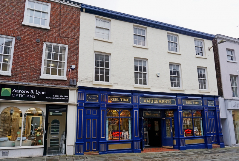
1. GREAT UNDERBANK
(East Side)
No 19
SJ 8890 NE 1/73
II GV
2.
Early C19. 3 storeys in painted brick. 4 windows, segmental heads to top
floor, hung sashes with glazing bars to 1st floor. Modern shop front.
Nos 13 to 23 (odd) form a group.
Listing NGR: SJ8959890531
External links are from the relevant listing authority and, where applicable, Wikidata. Wikidata IDs may be related buildings as well as this specific building. If you want to add or update a link, you will need to do so by editing the Wikidata entry.


Other nearby listed buildings
