Latitude: 51.3162 / 51°18'58"N
Longitude: 0.8893 / 0°53'21"E
OS Eastings: 601443
OS Northings: 161419
OS Grid: TR014614
Mapcode National: GBR SW3.HMX
Mapcode Global: VHKJW.C5HT
Plus Code: 9F328V8Q+FP
Entry Name: 18, West Street
Listing Date: 3 August 1972
Grade: II
Source: Historic England
Source ID: 1067561
English Heritage Legacy ID: 438535
ID on this website: 101067561
Location: Faversham, Swale, Kent, ME13
County: Kent
District: Swale
Civil Parish: Faversham
Built-Up Area: Faversham
Traditional County: Kent
Lieutenancy Area (Ceremonial County): Kent
Tagged with: Building
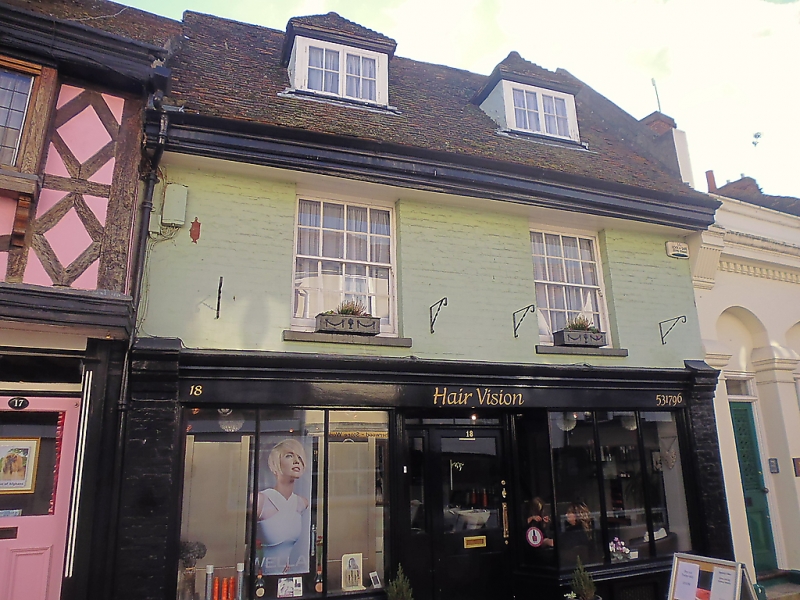
WEST STREET
1.
1103 (South Side)
------------
No 18
TR 0161 SW 2/113
II
2.
C18 front to Cl6 building. 2 storeys. 2 windows. Painted brick.
Eaves cornice. Tiled roof. Glazing bars missing. C19 shop front,
Which has been modernized.
Listing NGR: TR0144261414
External links are from the relevant listing authority and, where applicable, Wikidata. Wikidata IDs may be related buildings as well as this specific building. If you want to add or update a link, you will need to do so by editing the Wikidata entry.


Other nearby listed buildings