Approximate Location Map
Large Map »
Latitude: 51.3161 / 51°18'58"N
Longitude: 0.8896 / 0°53'22"E
OS Eastings: 601464
OS Northings: 161411
OS Grid: TR014614
Mapcode National: GBR SW3.HQ4
Mapcode Global: VHKJW.C5NW
Plus Code: 9F328V8Q+FR
Entry Name: 14, West Street
Listing Date: 3 August 1972
Grade: II
Source: Historic England
Source ID: 1074910
English Heritage Legacy ID: 438533
ID on this website: 101074910
Location: Faversham, Swale, Kent, ME13
County: Kent
District: Swale
Civil Parish: Faversham
Built-Up Area: Faversham
Traditional County: Kent
Lieutenancy Area (Ceremonial County): Kent
Tagged with: Building
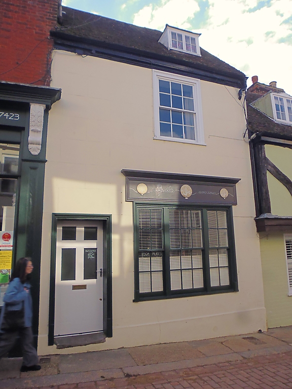
WEST STREET
1.
1103 (South Side)
------------
No 14
TR 0161 SW 2/111
II
2.
C18. 2 storeys and attic. 1 window. 1 dormer. Stuccoed. Wooden eaves
cornice. Tiled roof. Glazing bars intact on the 1st floor. Modern shop
window.
Listing NGR: TR0146361410
External links are from the relevant listing authority and, where applicable, Wikidata. Wikidata IDs may be related buildings as well as this specific building. If you want to add or update a link, you will need to do so by editing the Wikidata entry.


Other nearby listed buildings
