Approximate Location Map
Large Map »
Latitude: 51.3168 / 51°19'0"N
Longitude: 0.8862 / 0°53'10"E
OS Eastings: 601225
OS Northings: 161474
OS Grid: TR012614
Mapcode National: GBR SW3.8WD
Mapcode Global: VHKJW.95VD
Plus Code: 9F328V8P+PF
Entry Name: 73 and 74, West Street
Listing Date: 3 August 1972
Grade: II
Source: Historic England
Source ID: 1067601
English Heritage Legacy ID: 438548
ID on this website: 101067601
Location: Davington, Swale, Kent, ME13
County: Kent
District: Swale
Civil Parish: Faversham
Built-Up Area: Faversham
Traditional County: Kent
Lieutenancy Area (Ceremonial County): Kent
Tagged with: Building
TR 0161 SW
2/124
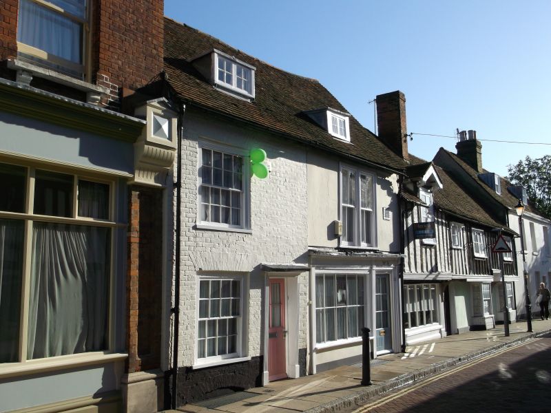
WEST STREET (North Side)
Nos.73 and 74
II
C18 front to a C15 timber-framed building. Two storeys and attic. Two windows. Two dormers. No.75 painted brick, No.74 stuccoed. Parapet. Tiled roof. Glazing bars intact in No.73 only. C19 shop window in No.74, flanked by pilasters and moulded frieze with projecting cornice over.
Listing NGR: TR0122661478
External links are from the relevant listing authority and, where applicable, Wikidata. Wikidata IDs may be related buildings as well as this specific building. If you want to add or update a link, you will need to do so by editing the Wikidata entry.


Other nearby listed buildings
