Approximate Location Map
Large Map »
Latitude: 51.3168 / 51°19'0"N
Longitude: 0.8863 / 0°53'10"E
OS Eastings: 601231
OS Northings: 161474
OS Grid: TR012614
Mapcode National: GBR SW3.8XH
Mapcode Global: VHKJW.95XD
Plus Code: 9F328V8P+PG
Entry Name: 75, West Street
Listing Date: 4 May 1970
Grade: II
Source: Historic England
Source ID: 1067602
English Heritage Legacy ID: 438549
ID on this website: 101067602
Location: Davington, Swale, Kent, ME13
County: Kent
District: Swale
Civil Parish: Faversham
Built-Up Area: Faversham
Traditional County: Kent
Lieutenancy Area (Ceremonial County): Kent
Tagged with: Building
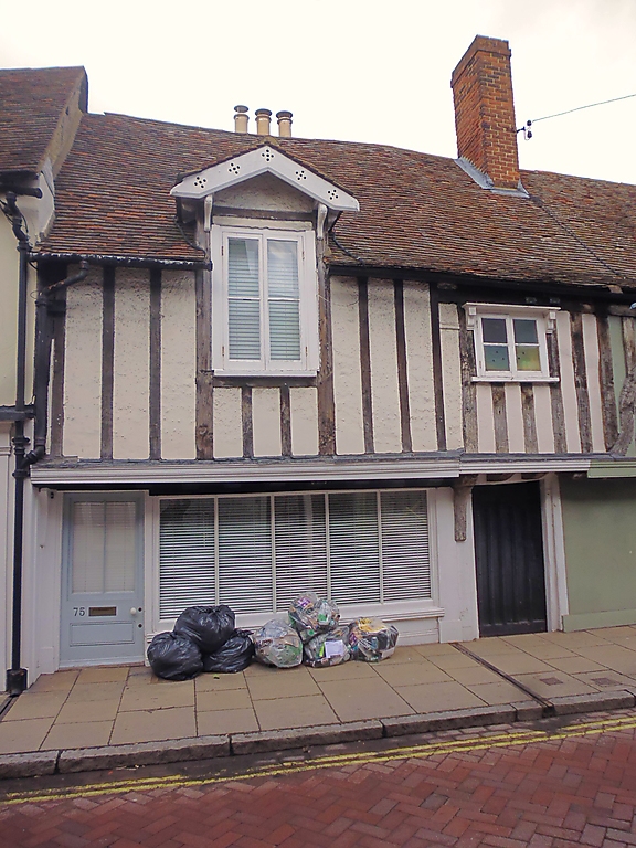
WEST STREET
1.
ll03 (North Side)
------------
No 75
TR 0161 SW 2/125 4.5.70.
II
2.
Cl5 timber-framed house with 1st floor jettied on the protruding ends
of the floor joists, but refronted and now faced with imitation timbering
and cement infilling. Tiled roof. Modern windows and shop window. 2
storeys. 2 windows. Now also forms part of the Castle Inn.
Listing NGR: TR0124161479
External links are from the relevant listing authority and, where applicable, Wikidata. Wikidata IDs may be related buildings as well as this specific building. If you want to add or update a link, you will need to do so by editing the Wikidata entry.


Other nearby listed buildings
