Approximate Location Map
Large Map »
Latitude: 54.5239 / 54°31'26"N
Longitude: -2.6911 / 2°41'27"W
OS Eastings: 355366
OS Northings: 514513
OS Grid: NY553145
Mapcode National: GBR 9JN4.52
Mapcode Global: WH81Y.MKQ7
Plus Code: 9C6VG8F5+HH
Entry Name: Keld Chapel
Listing Date: 8 October 2002
Grade: II
Source: Historic England
Source ID: 1067845
English Heritage Legacy ID: 489830
ID on this website: 101067845
Location: Keld, Westmorland and Furness, Cumbria, CA10
County: Cumbria
District: Eden
Civil Parish: Shap
Built-Up Area: Shap
Traditional County: Westmorland
Lieutenancy Area (Ceremonial County): Cumbria
Church of England Parish: Shap with Swindale St Michael
Church of England Diocese: Carlisle
SHAP
1254/0/10009 Keld Chapel
08-OCT-02
II
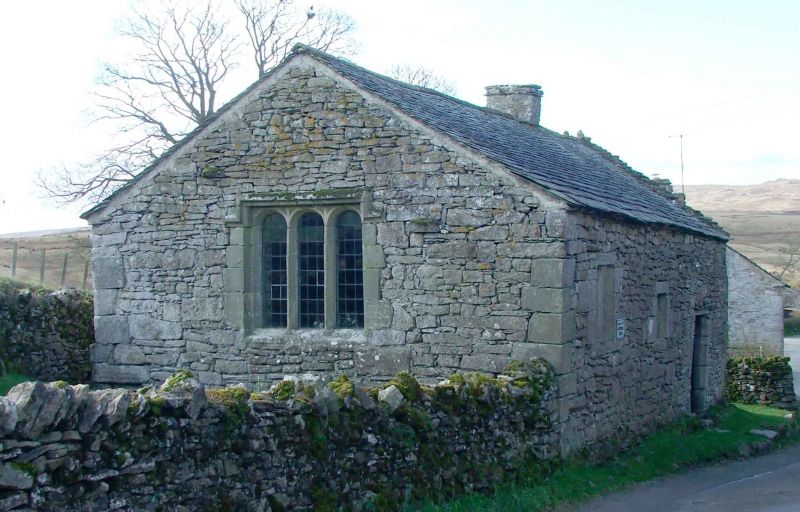
Chapel. Late C16, used as a dwelling between late C17 and C19, repaired and restored to use as a place of worship early C20. Coursed rubble limestone with limestone dressings , single ridge chimney and a Westmorland slate roof covering, laid to diminishing courses.
PLAN: Simple 2-cell plan, the result of domestic conversion, and aligned north-east / south-west .
EXTERIOR: North-east gable with 3 light window, the lights with elliptically-arched heads below a re-set label mould. North-west elevation with 2 flat-headed windows and a doorway, all within irregularly-quoined surrounds, the windows of one and 2 lights, the doorway with chamfered jambs and a later lintel. South-east elevation with 2 windows similar to those to the north-west wall, and a blocked c.1700 window.
INTERIOR: Simply-furnished interior subdivided by a cross wall with inserted domestic hearth with stepped jambs and irregular, narrow lintel. Inserted recess to left. Unplastered stonework and exposed rafters and purlins.
HISTORY: The first documentary reference to Keld Chapel is a christening in 1672. In the late C17, the building ceased to be used as a place of worship and was converted into a dwelling. The building was repaired in 1897 and became the property of the National Trust in the early C20. The building stands within a small churchyard bounded by an enclosure wall, which, together with the ground below the chapel is a Scheduled Ancient Monument ( No. 34988. )
External links are from the relevant listing authority and, where applicable, Wikidata. Wikidata IDs may be related buildings as well as this specific building. If you want to add or update a link, you will need to do so by editing the Wikidata entry.


Other nearby listed buildings
