Approximate Location Map
Large Map »
Latitude: 53.4381 / 53°26'17"N
Longitude: -2.0846 / 2°5'4"W
OS Eastings: 394478
OS Northings: 393479
OS Grid: SJ944934
Mapcode National: GBR FXWP.H8
Mapcode Global: WHB9Q.YVJ5
Plus Code: 9C5VCWQ8+65
Entry Name: Apethorn Farmhouse
Listing Date: 22 December 1969
Grade: II*
Source: Historic England
Source ID: 1068079
English Heritage Legacy ID: 212470
ID on this website: 101068079
Location: Woodley, Tameside, Greater Manchester, SK14
County: Tameside
Electoral Ward/Division: Hyde Werneth
Parish: Non Civil Parish
Built-Up Area: Hyde (Tameside)
Traditional County: Cheshire
Lieutenancy Area (Ceremonial County): Greater Manchester
Church of England Parish: Gee Cross Holy Trinity
Church of England Diocese: Chester
Tagged with: Farmhouse
HYDE APETHORN LANE
SJ 99 SW (south side)
6/14 Apethorn
22.12.69 Farmhouse
- II*
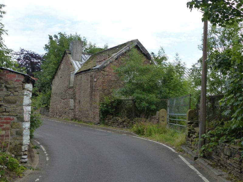
Farmhouse and shippon. C15 but with external walls and
other features of the C17 to C19. Cruck-framed with brick
and squared rubble walls and a graduated stone slate roof.
Originally a 4-bay cruck-framed open-hall house (probably a
long-house) but with a floor inserted in the C17 and other
alterations during conversion to cottages. The elevation
consists of a small gabled wing in bay 1, and a second bay
both of which are in stone. The other 3 bays are in brick
and have 3 doors relating to their use as a shippon. One
ridge chimney. The east elevation, again with 3 bays in
brick and the remainder in stone has 3 dormer windows rising
from the eaves, one of them gabled. The gable onto the road
has one ground floor window and a sash window above. The
internal cruck-frame and roof construction are of particular
note: 4 out of the 5 original cruck trusses survive; they
have (although some have been removed) tie beams, collar
ties and collar yokes and support the original roof
construction. The second frame, now in the shippon, has an
unusual feature on the east blade of a simply carved capital
with rudimentary column beneath. An important example of an
early house-type few of which remain in Greater Manchester.
See report and plans by A. Pacey, December 1968 and R.C.H.M.
photographic survey.
Listing NGR: SJ9447893479
External links are from the relevant listing authority and, where applicable, Wikidata. Wikidata IDs may be related buildings as well as this specific building. If you want to add or update a link, you will need to do so by editing the Wikidata entry.


Other nearby listed buildings
