Latitude: 53.4422 / 53°26'32"N
Longitude: -2.097 / 2°5'49"W
OS Eastings: 393650
OS Northings: 393943
OS Grid: SJ936939
Mapcode National: GBR FXSM.SS
Mapcode Global: WHB9Q.RQLZ
Plus Code: 9C5VCWR3+V5
Entry Name: Manor Farmhouse
Listing Date: 27 November 1967
Last Amended: 14 July 1987
Grade: II
Source: Historic England
Source ID: 1356485
English Heritage Legacy ID: 212698
ID on this website: 101356485
Location: Haughton Green, Tameside, Greater Manchester, M34
County: Tameside
Electoral Ward/Division: Denton South
Parish: Non Civil Parish
Built-Up Area: Denton
Traditional County: Lancashire
Lieutenancy Area (Ceremonial County): Greater Manchester
Church of England Parish: Haughton Green St Mary the Virgin
Church of England Diocese: Manchester
Tagged with: Farmhouse
DENTON HAUGHTON GREEN ROAD SJ 99 SW (east side)
7/45 No. 69 27/11/67 (Manor Farmhouse) (formerly listed as Manor Farmhouse)
- II
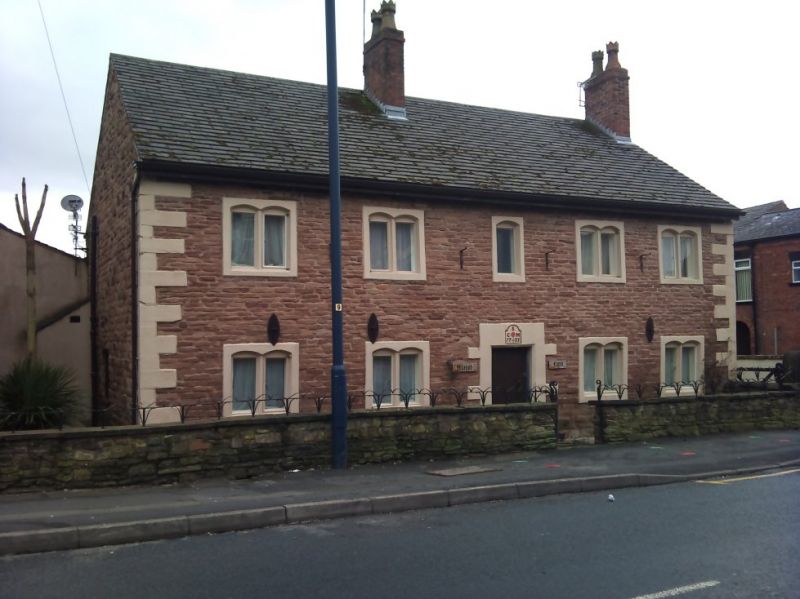
Farmhouse. "CSM 1735" (Sidebottom) on door lintel. Hammer- dressed stone with C20 tile roof and brick chimney stacks. Total of 5 bays and 2 storeys. Single-depth plan. Symmetrical elevation with quoins and ridge and gable chimney stacks. Central studded battened door with chamfered surround and dated lintel. Four 2-light chamfered mullion windows with segmental-arched heads on each floor and a similar one but of 1 light in the middle of the first floor. All have been altered. C20 porch to rear which is rendered and has C20 casement windows.
Listing NGR: SJ9365093943
External links are from the relevant listing authority and, where applicable, Wikidata. Wikidata IDs may be related buildings as well as this specific building. If you want to add or update a link, you will need to do so by editing the Wikidata entry.


Other nearby listed buildings