Latitude: 53.5568 / 53°33'24"N
Longitude: -2.1516 / 2°9'5"W
OS Eastings: 390055
OS Northings: 406691
OS Grid: SD900066
Mapcode National: GBR FWD9.ZQ
Mapcode Global: WHB93.XVMP
Plus Code: 9C5VHR4X+M9
Entry Name: Church of Saint Matthew
Listing Date: 30 May 1963
Grade: II
Source: Historic England
Source ID: 1068092
English Heritage Legacy ID: 212406
Also known as: St Matthew's Church, Chadderton
ID on this website: 101068092
Location: St Matthew's Church, Top of Cragg, Oldham, Greater Manchester, OL1
County: Oldham
Electoral Ward/Division: Chadderton North
Parish: Non Civil Parish
Built-Up Area: Chadderton
Traditional County: Lancashire
Lieutenancy Area (Ceremonial County): Greater Manchester
Church of England Parish: Chadderton St Matthew and St Luke
Church of England Diocese: Manchester
Tagged with: Church building
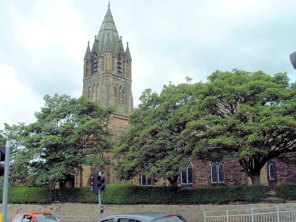
SD 90 SW CHADDERTON CHADDERTON HALL ROAD (north side) 4/3 Church of 30/5/63 St. Matthew - II Church. 1848-57. By E. H. Shellard. Hammer-dressed stone with slate roof. Nave and chancel with south-west tower (added c.1878) and flat-roofed C20 additions to west and north. 4-bay nave with projecting plinth and gableted buttresses. Each bay has a 2-light window with reticulated tracery. 2-bay chancel with cusped lancet windows. Coped gables with finials. 3-stage tower with clasping buttresses has arched door, small lancet openings and a squat spire which sits behind corner pinnacles and accommodates the belfry with gabled 2-light openings. Interior: west gallery with blind arcaded parapet on cast-iron columns. Arch-braced collar-tie roof trusses on carved corbtes. Wagon roof to chancel. Timber fittings and stone font. Stained glass, some by Kempe and Tower, other by F. Comere and Capronnier.
Listing NGR: SD9005506691
External links are from the relevant listing authority and, where applicable, Wikidata. Wikidata IDs may be related buildings as well as this specific building. If you want to add or update a link, you will need to do so by editing the Wikidata entry.


Other nearby listed buildings