Latitude: 53.404 / 53°24'14"N
Longitude: -2.9729 / 2°58'22"W
OS Eastings: 335416
OS Northings: 390128
OS Grid: SJ354901
Mapcode National: GBR 76P.XR
Mapcode Global: WH877.9PLS
Plus Code: 9C5VC23G+JR
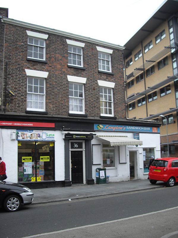
Entry Name: 36, Clarence Street
Listing Date: 19 June 1985
Grade: II
Source: Historic England
Source ID: 1068296
English Heritage Legacy ID: 213939
ID on this website: 101068296
Location: Liverpool, Merseyside, L3
County: Liverpool
Electoral Ward/Division: Central
Parish: Non Civil Parish
Built-Up Area: Liverpool
Traditional County: Lancashire
Lieutenancy Area (Ceremonial County): Merseyside
Church of England Parish: St Luke in the City Team
Church of England Diocese: Liverpool
Tagged with: Building
SJ 3590 SW CLARENCE STREET L3 54/311 No 36 -
G.V. II
Shop. Early C19. Brick with stone dressings and slate roof. 3 storeys and 3 bays. Top cornice. Ground floor C20 with original door case. Upper floors have sashed windows with glazing bars and wedge lintels.
Listing NGR: SJ3541690128
External links are from the relevant listing authority and, where applicable, Wikidata. Wikidata IDs may be related buildings as well as this specific building. If you want to add or update a link, you will need to do so by editing the Wikidata entry.


Other nearby listed buildings