Approximate Location Map
Large Map »
Latitude: 51.071 / 51°4'15"N
Longitude: 1.0809 / 1°4'51"E
OS Eastings: 615933
OS Northings: 134704
OS Grid: TR159347
Mapcode National: GBR V0L.XR8
Mapcode Global: FRA F649.4X5
Plus Code: 9F3333CJ+C8
Entry Name: Rear Portion of No 2
Listing Date: 21 December 1973
Last Amended: 23 October 1974
Grade: II
Source: Historic England
Source ID: 1068970
English Heritage Legacy ID: 175086
ID on this website: 101068970
Location: Hythe, Folkestone and Hythe, Kent, CT21
County: Kent
District: Folkestone and Hythe
Civil Parish: Hythe
Built-Up Area: Hythe
Traditional County: Kent
Lieutenancy Area (Ceremonial County): Kent
Tagged with: Building
1.
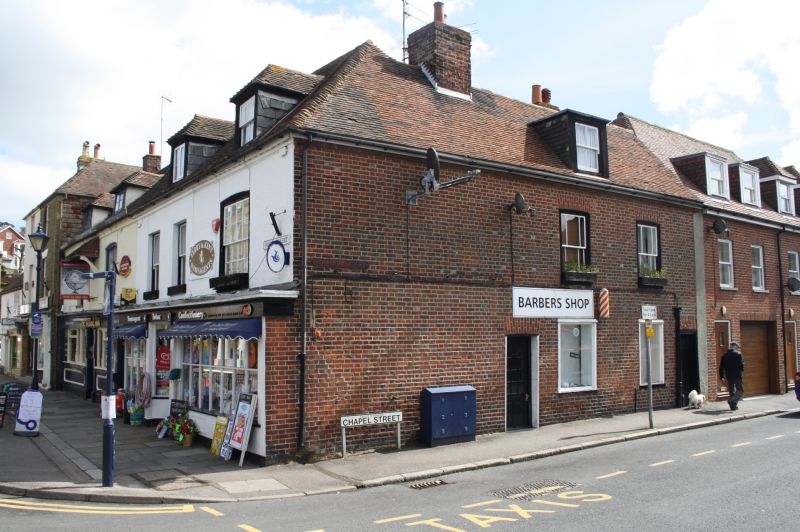
1253 CHAPEL STREET
(North Side)
Nos 1 and 3
TR 1534 NE 1/63
II GV
2.
C18. 2 storeys and attics, red brick. Tiled roof and modillion eaves cornice. 1 window and
1 dormer each.
Nos 1 and 3 form a group with the South Front of No 2 High Street.
Nos 1 and 3 shall be amended to read Rear portion of No 2 High Street.
------------------------------------
1.
1253 CHAPEL STREET
(North Side)
Nos 1 and 3
TR 1534 NE 1/63
II GV
2.
C18. 2 storeys and attics, red brick. Tiled roof and modillion eaves cornice.
1 window and 1 dormer each.
Nos 1 and 3 form a group with the South Front of 2 High Street.
Listing NGR: TR1593334704
External links are from the relevant listing authority and, where applicable, Wikidata. Wikidata IDs may be related buildings as well as this specific building. If you want to add or update a link, you will need to do so by editing the Wikidata entry.


Other nearby listed buildings
