Latitude: 51.0712 / 51°4'16"N
Longitude: 1.0817 / 1°4'54"E
OS Eastings: 615990
OS Northings: 134730
OS Grid: TR159347
Mapcode National: GBR V0L.Q9T
Mapcode Global: FRA F649.578
Plus Code: 9F3333CJ+FM
Entry Name: 36, High Street
Listing Date: 21 December 1973
Grade: II
Source: Historic England
Source ID: 1068984
English Heritage Legacy ID: 175117
ID on this website: 101068984
Location: Hythe, Folkestone and Hythe, Kent, CT21
County: Kent
District: Folkestone and Hythe
Civil Parish: Hythe
Built-Up Area: Hythe
Traditional County: Kent
Lieutenancy Area (Ceremonial County): Kent
Tagged with: Building
1.
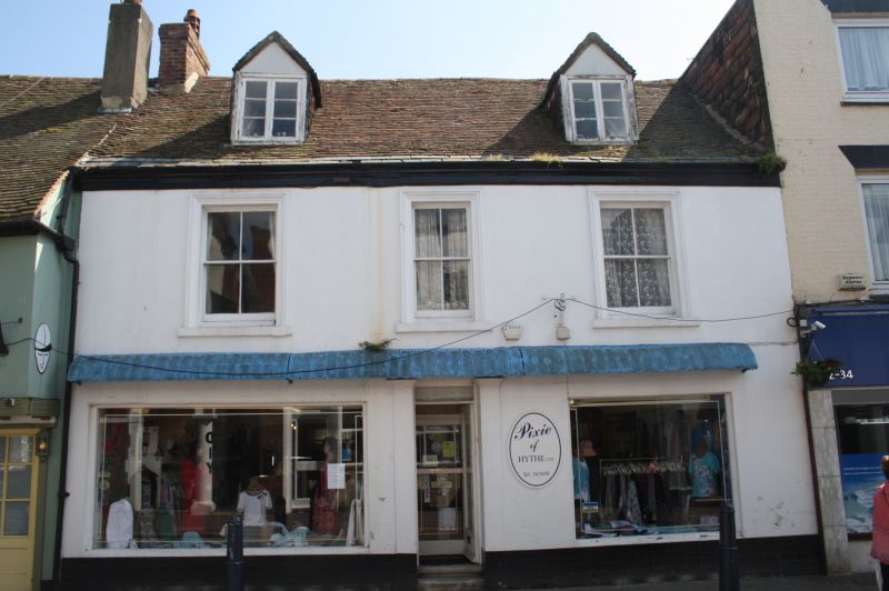
1253 HIGH STREET
(South Side)
No 36
TR 1534 NE 1/101
II GV
2.
C18. 2 storeys stuccoed. Tiled roof with 2 hipped dormers. 3 sashes with
verticals only, set in moulded architraves. Cl9 shop front with a 4 panelled
door and 2 plain pilasters.
Nos 32 to 40 (even) form a group.
Listing NGR: TR1599034730
External links are from the relevant listing authority and, where applicable, Wikidata. Wikidata IDs may be related buildings as well as this specific building. If you want to add or update a link, you will need to do so by editing the Wikidata entry.


Other nearby listed buildings