Latitude: 51.3412 / 51°20'28"N
Longitude: 0.6853 / 0°41'7"E
OS Eastings: 587130
OS Northings: 163660
OS Grid: TQ871636
Mapcode National: GBR QRT.S49
Mapcode Global: VHJM3.TKP5
Plus Code: 9F328MRP+F4
Entry Name: Chestnut Street Farmhouse
Listing Date: 24 January 1967
Grade: II
Source: Historic England
Source ID: 1069384
English Heritage Legacy ID: 176050
ID on this website: 101069384
Location: Chestnut Street, Swale, Kent, ME9
County: Kent
District: Swale
Civil Parish: Borden
Traditional County: Kent
Lieutenancy Area (Ceremonial County): Kent
Tagged with: Farmhouse
TQ 86 SE BORDEN CHESTNUT STREET (south side)
5/20 Chestnut Street Farmhouse 24.1.67 II
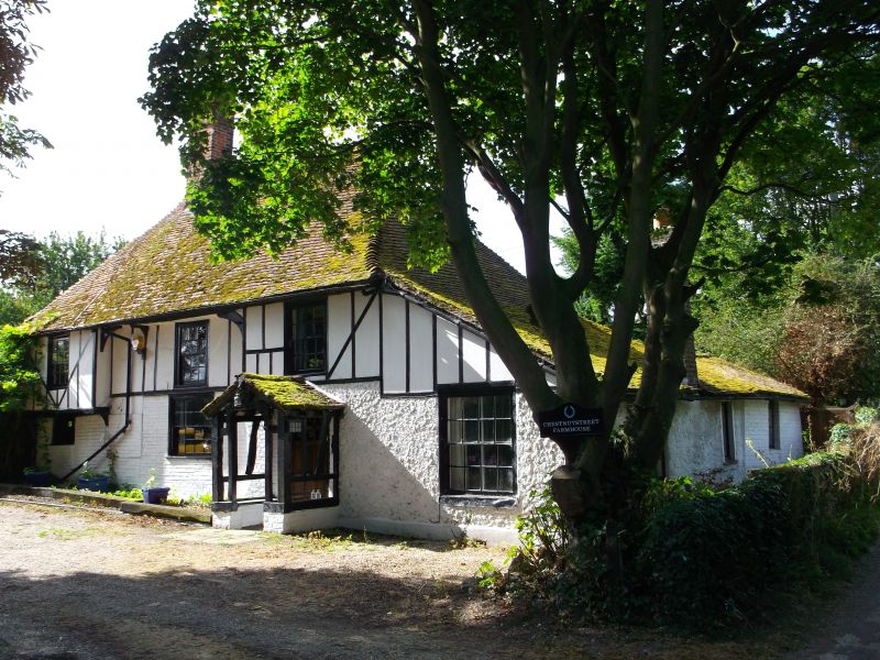
Wealden hall house. C16 and C17, clad C19. Timber framed and clad with rendered brick and imitation timber frame. Three framed bays and screens passage. Two storeys, jettied first floor left, underbuilt jetty to right. Arch braced flying wall-plate to central recessed bay. Hipped roof with gablets and catslide out- shot to right and stack to end left. Irregular fenestration of 3 glazing bar sashes to each floor and half-glazed and panelled door to right in half-timbered gabled porch. Interior: the right hand wing was rebuilt 1609, as carved and dated beam indicates, probable date of inserted ceiling to hall, and blocking off screens passage (survives internally to left). The C17 wing with blocked door to right return front with carved Ionic columns and cornice. Remnants of dias beam in hall. Crown post roof.
Listing NGR: TQ8713063660
External links are from the relevant listing authority and, where applicable, Wikidata. Wikidata IDs may be related buildings as well as this specific building. If you want to add or update a link, you will need to do so by editing the Wikidata entry.


Other nearby listed buildings