Approximate Location Map
Large Map »
Latitude: 51.3394 / 51°20'21"N
Longitude: 0.6851 / 0°41'6"E
OS Eastings: 587120
OS Northings: 163454
OS Grid: TQ871634
Mapcode National: GBR QRT.S2C
Mapcode Global: VHJM3.TLJL
Plus Code: 9F328MQP+P2
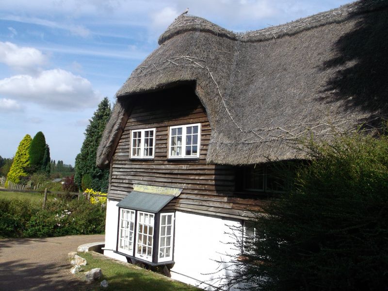
Entry Name: The Thatched Cottage
Listing Date: 27 November 1984
Grade: II
Source: Historic England
Source ID: 1069385
English Heritage Legacy ID: 176051
ID on this website: 101069385
Location: Chestnut Street, Swale, Kent, ME9
County: Kent
District: Swale
Civil Parish: Borden
Traditional County: Kent
Lieutenancy Area (Ceremonial County): Kent
Tagged with: Cottage Thatched cottage
TQ 86 SE BORDEN CHESTNUT WOOD LANE
(east side)
5/21 The Thatched Cottage
II
House. C17. Timber framed, clad in painted brick and plaster, with
thatched roof. Two storeys and hipped roof with stacks to centre
and end left and hipped extension stepped down to left. Irregular
fenestration of 3 wood casements to first floor, 5 to ground floor
and half-door and side-lights to left.
Listing NGR: TQ8712063454
External links are from the relevant listing authority and, where applicable, Wikidata. Wikidata IDs may be related buildings as well as this specific building. If you want to add or update a link, you will need to do so by editing the Wikidata entry.


Other nearby listed buildings
