Latitude: 51.3118 / 51°18'42"N
Longitude: 0.8718 / 0°52'18"E
OS Eastings: 600241
OS Northings: 160878
OS Grid: TR002608
Mapcode National: GBR RTR.R77
Mapcode Global: VHKJW.2977
Plus Code: 9F328V6C+PP
Entry Name: 59, Ospringe Street
Listing Date: 3 August 1972
Grade: II
Source: Historic England
Source ID: 1069433
English Heritage Legacy ID: 175963
ID on this website: 101069433
Location: Ospringe, Swale, Kent, ME13
County: Kent
District: Swale
Civil Parish: Faversham
Built-Up Area: Faversham
Traditional County: Kent
Lieutenancy Area (Ceremonial County): Kent
Tagged with: Building
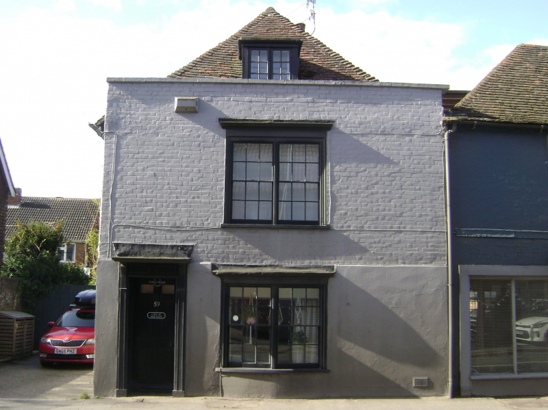
OSPRINGE STREET
1.
1103 (South Side)
---------------
No 59
TR 0060 11/176
II
2.
C18. 2 storeys and attic. 1 window. 1 dormer. Painted brick. Parapet.
Twin window on each floor with cornice over and glazing bars intact.
Doorway with pilasters, projecting cornice and door of 6 panels, centre
2 moulded and top 2 cut away and glazed.
Listing NGR: TR0023960875
External links are from the relevant listing authority and, where applicable, Wikidata. Wikidata IDs may be related buildings as well as this specific building. If you want to add or update a link, you will need to do so by editing the Wikidata entry.


Other nearby listed buildings