Approximate Location Map
Large Map »
Latitude: 51.3116 / 51°18'41"N
Longitude: 0.8725 / 0°52'20"E
OS Eastings: 600290
OS Northings: 160863
OS Grid: TR002608
Mapcode National: GBR RTR.RDR
Mapcode Global: VHKJW.29LC
Plus Code: 9F328V6C+JX
Entry Name: 41 and 43, Ospringe Street
Listing Date: 3 August 1972
Grade: II
Source: Historic England
Source ID: 1343869
English Heritage Legacy ID: 175962
ID on this website: 101343869
Location: Ospringe, Swale, Kent, ME13
County: Kent
District: Swale
Civil Parish: Faversham
Built-Up Area: Faversham
Traditional County: Kent
Lieutenancy Area (Ceremonial County): Kent
Tagged with: Building
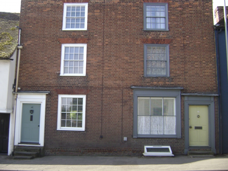
OSPRINGE STREET
1.
1103 (South Side)
---------------
Nos 41 & 43
TR 0060 11/174
II GV
2.
A pair of early Cl9 houses. 3 storeys. 2 windows. Red brick.
Parapet. Glazing bars intact. Doorways in moulded architrave
surrounds With projecting cornices over and 4-panel doors.
Nos 31 to 45 (odd) form a group.
Listing NGR: TR0029260859
External links are from the relevant listing authority and, where applicable, Wikidata. Wikidata IDs may be related buildings as well as this specific building. If you want to add or update a link, you will need to do so by editing the Wikidata entry.


Other nearby listed buildings
