Latitude: 51.2757 / 51°16'32"N
Longitude: 1.3406 / 1°20'26"E
OS Eastings: 633093
OS Northings: 158253
OS Grid: TR330582
Mapcode National: GBR X12.XDM
Mapcode Global: VHLGS.663C
Plus Code: 9F3378GR+77
Entry Name: 50, St Peter's Street
Listing Date: 19 June 1991
Grade: II
Source: Historic England
Source ID: 1069518
English Heritage Legacy ID: 177718
ID on this website: 101069518
Location: Sandwich, Dover, Kent, CT13
County: Kent
District: Dover
Civil Parish: Sandwich
Built-Up Area: Sandwich
Traditional County: Kent
Lieutenancy Area (Ceremonial County): Kent
Tagged with: Building
TR 3358 SANDWICH St. Peter's Street 5/358 No. 50
GV II
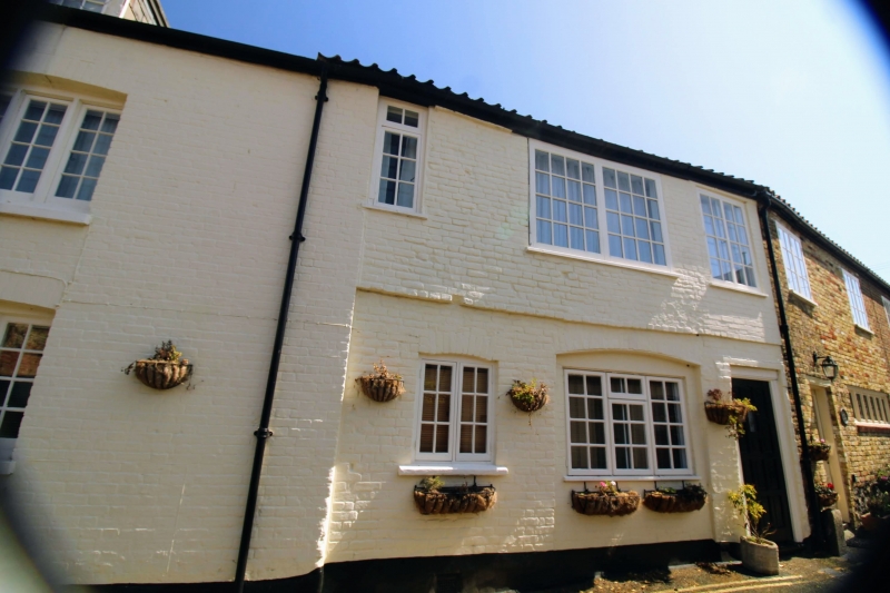
House, former late Norman 1st floor hall house. North east wall probably c.1216 rest c18 and C19 altered in C20. North east wall is of flint, stone and brick incorporating 2 ealy English pointed arched stone window surrounds with leaded lights and remains of a blocked third window. Some portions of old brickwork. Ground floor has blocked cambered arch with red brick voussoirs. To north is C20 flat roofed dormer and ground floor extension. Rest of south part of building is C18 altered in C20 and north part is C19. South part has ground floor of painted Flemish bond and 1st floor of random band with tiled roof. C20 fixed sashes, ground floor blocked in carriage entrance and C20 door and north part has painted Flemish bond brickwork with slate roof, C20 dormer with casement and C19 3 light cambered casement below.
Listing NGR: TR3309858252
External links are from the relevant listing authority and, where applicable, Wikidata. Wikidata IDs may be related buildings as well as this specific building. If you want to add or update a link, you will need to do so by editing the Wikidata entry.


Other nearby listed buildings