Approximate Location Map
Large Map »
Latitude: 51.2745 / 51°16'28"N
Longitude: 1.3404 / 1°20'25"E
OS Eastings: 633079
OS Northings: 158121
OS Grid: TR330581
Mapcode National: GBR X18.3P0
Mapcode Global: VHLGS.57Y8
Plus Code: 9F3378FR+R4
Entry Name: 5, King Street
Listing Date: 19 May 1950
Grade: II*
Source: Historic England
Source ID: 1069630
English Heritage Legacy ID: 177481
ID on this website: 101069630
Location: Sandwich, Dover, Kent, CT13
County: Kent
District: Dover
Civil Parish: Sandwich
Built-Up Area: Sandwich
Traditional County: Kent
Lieutenancy Area (Ceremonial County): Kent
Tagged with: Building
1.
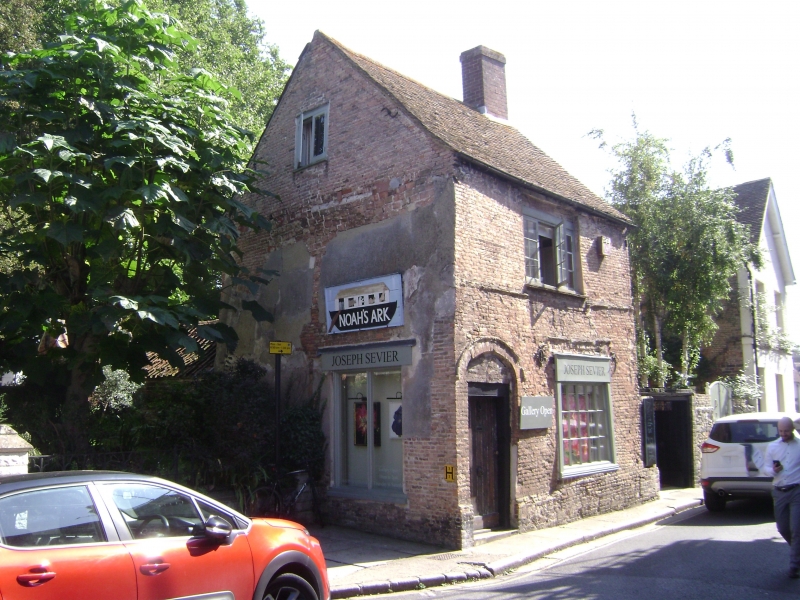
5275 KING STREET
(North East Side)
No 5
TR 3358 1/98 19.5.50.
II*
2.
C16 2 storey building with tiled roof. One window, small red Dutch brick,
stringcourse. Early C19 small shop window having plain pilasters and plain
fascia over with beaded edging, glazing bars intact. 4 centred arch over doorway
with drips over. Ceiling beams inside. Wrought iron ties in 4 places. Label
string over shop window and string under 1st floor window.
Listing NGR: TR3308058123
External links are from the relevant listing authority and, where applicable, Wikidata. Wikidata IDs may be related buildings as well as this specific building. If you want to add or update a link, you will need to do so by editing the Wikidata entry.


Other nearby listed buildings
