Latitude: 51.2752 / 51°16'30"N
Longitude: 1.3416 / 1°20'29"E
OS Eastings: 633166
OS Northings: 158201
OS Grid: TR331582
Mapcode National: GBR X12.XPV
Mapcode Global: VHLGS.66MR
Plus Code: 9F3378GR+3M
Entry Name: 11 AND 13, HIGH STREET (See details for further address information)
Listing Date: 23 April 1976
Grade: II
Source: Historic England
Source ID: 1069667
English Heritage Legacy ID: 177462
ID on this website: 101069667
Location: Sandwich, Dover, Kent, CT13
County: Kent
District: Dover
Civil Parish: Sandwich
Built-Up Area: Sandwich
Traditional County: Kent
Lieutenancy Area (Ceremonial County): Kent
Tagged with: Building
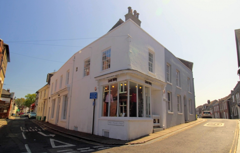
HIGH STREET 1. 5275 (East Side) Nos 11 and 13 TR 3358 1/144 II GV 2. Includes No 2 Upper Strand. These 2 buildings are of varying periods of 2 storeys, stuccoed and painted brick walls. No 11 has a mid C19 shop window at the north corner having vertical glazing bars only. Moulded cornice over with carved brackets either end and pilasters. Modern mosaic under windows. pair of modern doors in original openings. This block with its tiled roofs returns into Upper Strand Street having 2 first floor windows facing the Barbican containing original glazing bars. [Nos 11 to 19 (odd) with Nos 2 to 12 even U e+ Strand Street form a ou .]
Listing NGR: TR3317058193
External links are from the relevant listing authority and, where applicable, Wikidata. Wikidata IDs may be related buildings as well as this specific building. If you want to add or update a link, you will need to do so by editing the Wikidata entry.


Other nearby listed buildings