Latitude: 51.273 / 51°16'22"N
Longitude: 1.3411 / 1°20'27"E
OS Eastings: 633139
OS Northings: 157954
OS Grid: TR331579
Mapcode National: GBR X18.3W1
Mapcode Global: VHLGS.68BG
Plus Code: 9F3378FR+6C
Entry Name: 1, Galliard Street
Listing Date: 19 May 1950
Grade: II
Source: Historic England
Source ID: 1069689
English Heritage Legacy ID: 177415
ID on this website: 101069689
Location: Sandwich, Dover, Kent, CT13
County: Kent
District: Dover
Civil Parish: Sandwich
Built-Up Area: Sandwich
Traditional County: Kent
Lieutenancy Area (Ceremonial County): Kent
Tagged with: Building
1.
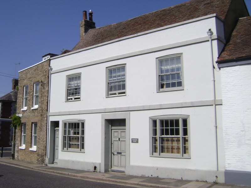
5275 GALLIARD STREET
(North Side)
No 1
TR 3357 2/96 19.5.50. 1
II GV
2.
C17 house altered in C8. 2 storeys, 3 windows, stuccoed front. Stringcourse
above each floor and parapet. Glazing bars intact on 1st floor. Doorway
with rectangular fanlight and modern ground floor windows.
Nos 1 to 5 (odd) with No 53 New Street form a group.
Listing NGR: TR3313657956
External links are from the relevant listing authority and, where applicable, Wikidata. Wikidata IDs may be related buildings as well as this specific building. If you want to add or update a link, you will need to do so by editing the Wikidata entry.


Other nearby listed buildings