Approximate Location Map
Large Map »
Latitude: 51.2731 / 51°16'23"N
Longitude: 1.3407 / 1°20'26"E
OS Eastings: 633109
OS Northings: 157963
OS Grid: TR331579
Mapcode National: GBR X18.3RQ
Mapcode Global: VHLGS.683C
Plus Code: 9F3378FR+67
Entry Name: 60, New Street
Listing Date: 8 February 1983
Grade: II
Source: Historic England
Source ID: 1249730
English Heritage Legacy ID: 431933
ID on this website: 101249730
Location: Sandwich, Dover, Kent, CT13
County: Kent
District: Dover
Civil Parish: Sandwich
Built-Up Area: Sandwich
Traditional County: Kent
Lieutenancy Area (Ceremonial County): Kent
Tagged with: Building
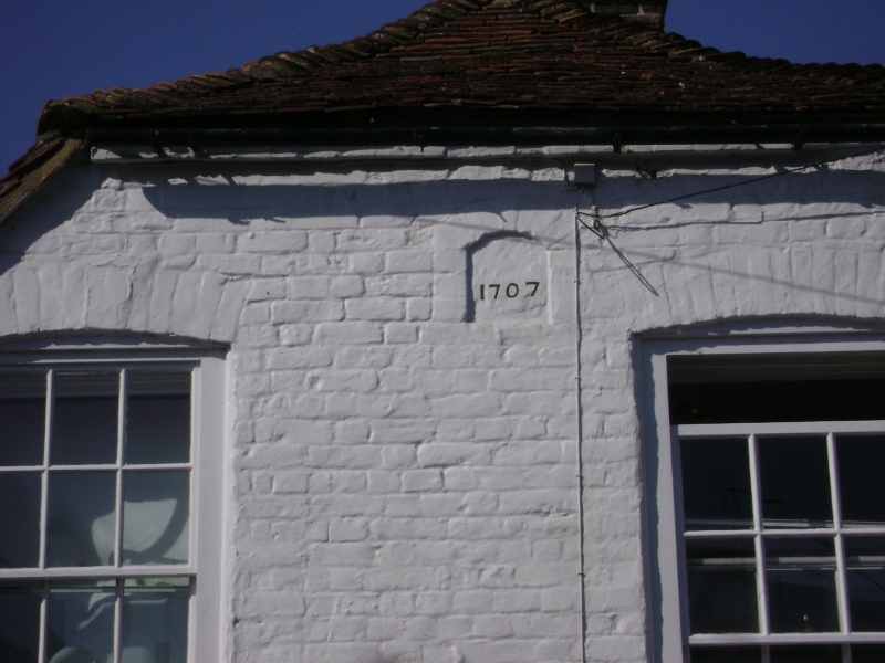
1. NEW STREET
5275 (south west side)
No 60
TR 3357 NW 2/93
II GV
2.
House dated 1707. Two storeys. Two windows, painted brick, half-hipped gable.
Brick relieving.arches over all windows and small plaque with date. Glazing bars
intact on first floor. Plain tiled roof. Included for group value.
Listing NGR: TR3310557962
External links are from the relevant listing authority and, where applicable, Wikidata. Wikidata IDs may be related buildings as well as this specific building. If you want to add or update a link, you will need to do so by editing the Wikidata entry.


Other nearby listed buildings
