Approximate Location Map
Large Map »
Latitude: 51.227 / 51°13'37"N
Longitude: 1.4037 / 1°24'13"E
OS Eastings: 637743
OS Northings: 153044
OS Grid: TR377530
Mapcode National: GBR X1Y.1PZ
Mapcode Global: VHMDG.8FY6
Plus Code: 9F336CG3+RF
Entry Name: 12 and 14, Farrier Street
Listing Date: 1 June 1949
Last Amended: 8 February 1974
Grade: II
Source: Historic England
Source ID: 1069843
English Heritage Legacy ID: 177081
ID on this website: 101069843
Location: Deal, Dover, Kent, CT14
County: Kent
District: Dover
Civil Parish: Deal
Built-Up Area: Deal
Traditional County: Kent
Lieutenancy Area (Ceremonial County): Kent
Tagged with: Building
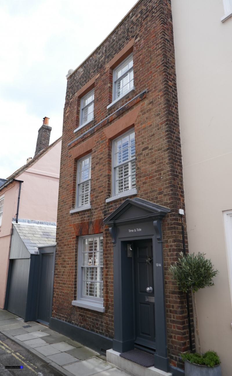
FARRIER STREET
1.
1035
(South Side)
Nos 12 and 14
(Formerly listed as
No 18)
TR 3753 SE 2/77 1.6.49.
II GV
2.
Early C19. 3 storeys brown brick. Parapet with stone coping having 2 ball finials.
2 sashes with glazing bars intact. Right side open pedimented doorcase with
wooden brackets and pilasters.
Nos 6 to 24 (even) form a group.
Listing NGR: TR3774353044
External links are from the relevant listing authority and, where applicable, Wikidata. Wikidata IDs may be related buildings as well as this specific building. If you want to add or update a link, you will need to do so by editing the Wikidata entry.


Other nearby listed buildings
