Approximate Location Map
Large Map »
Latitude: 51.227 / 51°13'37"N
Longitude: 1.4036 / 1°24'13"E
OS Eastings: 637736
OS Northings: 153036
OS Grid: TR377530
Mapcode National: GBR X1Y.1NW
Mapcode Global: VHMDG.8FW8
Plus Code: 9F336CG3+QC
Entry Name: 10, Farrier Street
Listing Date: 1 June 1949
Last Amended: 8 February 1974
Grade: II
Source: Historic England
Source ID: 1252105
English Heritage Legacy ID: 177080
ID on this website: 101252105
Location: Deal, Dover, Kent, CT14
County: Kent
District: Dover
Civil Parish: Deal
Built-Up Area: Deal
Traditional County: Kent
Lieutenancy Area (Ceremonial County): Kent
Tagged with: Building
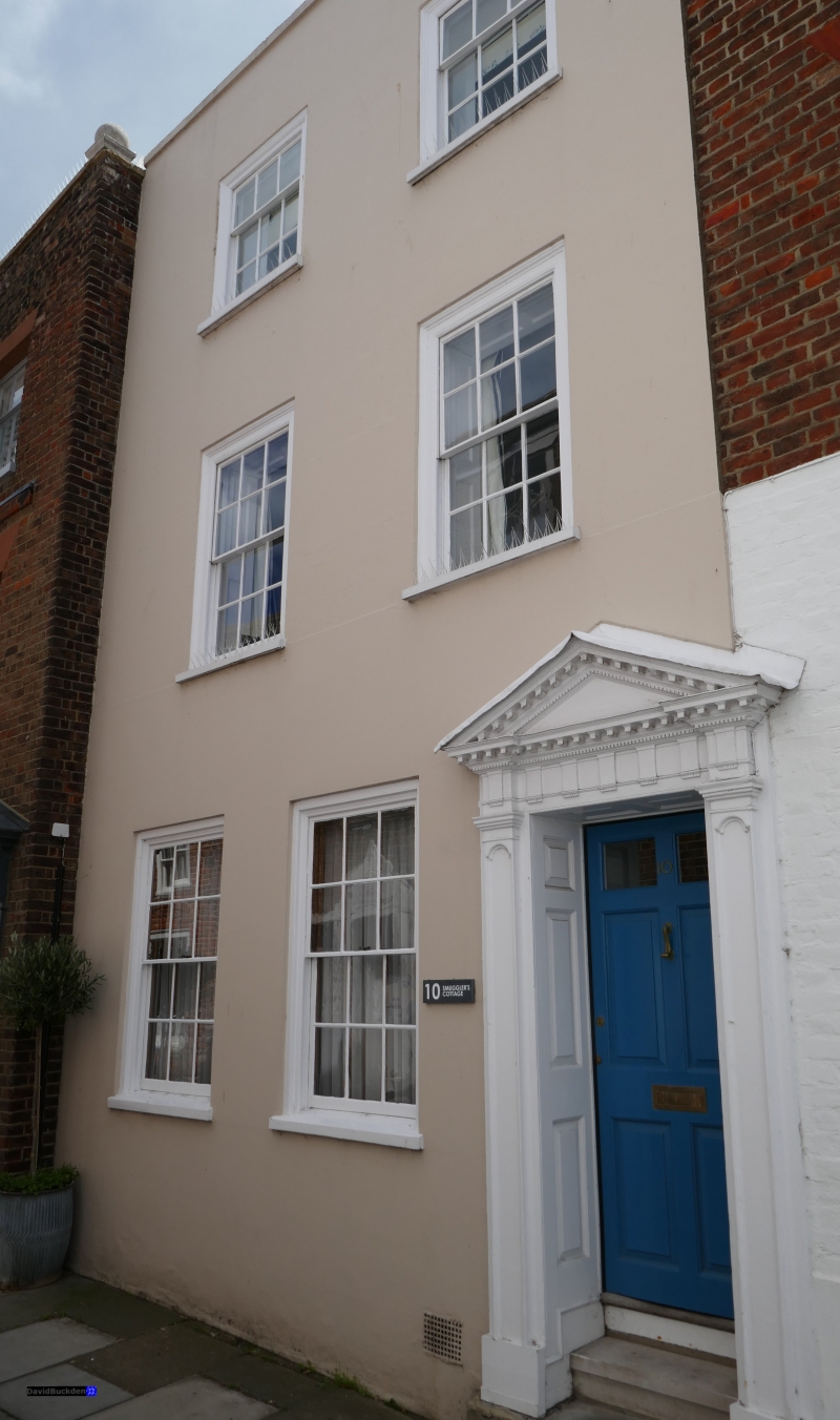
FARRIER STREET
1.
1035
(South Side)
No 10
(Formerly listed as
No 17)
TR 3753 SE 2/76 1.6.49.
II GV
2.
Early C19. 3 storeys stuccoed. Parapet with stone coping. 2 sashes with glazing
bars intact. Right side doorcase with open pediment, triglyph frieze, pilasters
and panelled reveals.
Nos 6 to 24 (even) form a group.
Listing NGR: TR3773653036
External links are from the relevant listing authority and, where applicable, Wikidata. Wikidata IDs may be related buildings as well as this specific building. If you want to add or update a link, you will need to do so by editing the Wikidata entry.


Other nearby listed buildings
