Latitude: 51.1973 / 51°11'50"N
Longitude: 0.2767 / 0°16'36"E
OS Eastings: 559171
OS Northings: 146697
OS Grid: TQ591466
Mapcode National: GBR MP0.YLL
Mapcode Global: VHHQ6.R55G
Plus Code: 9F3257WG+WM
Entry Name: 6-11, Church Street
Listing Date: 20 January 1972
Grade: II
Source: Historic England
Source ID: 1069964
English Heritage Legacy ID: 178665
ID on this website: 101069964
Location: The Park, Tonbridge and Malling, Kent, TN9
County: Kent
District: Tonbridge and Malling
Electoral Ward/Division: Medway
Parish: Non Civil Parish
Built-Up Area: Tonbridge
Traditional County: Kent
Lieutenancy Area (Ceremonial County): Kent
Church of England Parish: Tonbridge St Peter and St Paul
Church of England Diocese: Rochester
1. CHURCH STREET 1732 Nos 6 to 11 (consec) TQ 5946 NW 3/54
II GV
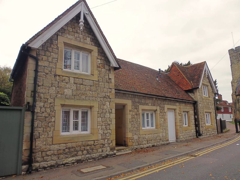
2. Almshouses originally founded in 1648 but rebuilt on the same site in 1847 in cottage Gothic style. The main front looks north over the Churchyard. Rough ashlar with faced stone quoins. The building consists of a single- storey centre portion containing 2 windows, 2 doorways and a gable in the centre, and 2 projecting wings of 2 storeys and 1 window each with gables over. Tiled roof. Octagonal white brick chimneys on stone bases. Windows and doorways in stone architrave surrounds. Casement windows with lozenge- shaped panes. The centre gable contains a stone recording the date and rebuilding of the Almshouses. The east front facing the street is similar to the Churchyard front except that it has no gable in the centre.
Nos I to 11 (consec) form a group with the Outbuilding opposite The Rose and Crown Tap, High Street
Listing NGR: TQ5916546696
External links are from the relevant listing authority and, where applicable, Wikidata. Wikidata IDs may be related buildings as well as this specific building. If you want to add or update a link, you will need to do so by editing the Wikidata entry.


Other nearby listed buildings