Latitude: 51.1978 / 51°11'52"N
Longitude: 0.2763 / 0°16'34"E
OS Eastings: 559137
OS Northings: 146749
OS Grid: TQ591467
Mapcode National: GBR MP0.YF8
Mapcode Global: VHHQ6.Q5X3
Plus Code: 9F3257XG+4G
Entry Name: Church House (Ymca)
Listing Date: 8 May 1950
Grade: II
Source: Historic England
Source ID: 1070006
English Heritage Legacy ID: 178663
ID on this website: 101070006
Location: The Park, Tonbridge and Malling, Kent, TN9
County: Kent
District: Tonbridge and Malling
Electoral Ward/Division: Medway
Parish: Non Civil Parish
Built-Up Area: Tonbridge
Traditional County: Kent
Lieutenancy Area (Ceremonial County): Kent
Church of England Parish: Tonbridge St Peter and St Paul
Church of England Diocese: Rochester
1. CHURCH LANE 1732 Church House (YMCA) TQ 5946 NW 3/57 8.5.50. II
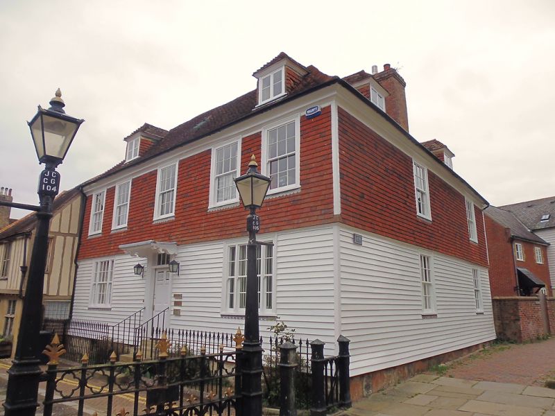
2. C18 front of weather-boarding on the ground floor and painted tiles above but with a slight bellcast between and trace of a moulded bressumer beneath the bellcast betokening an older timber-framed building beneath the front. 2 storeys and attic. 5 windows and 3 hipped dormers facing south, 2 windows and 2 dormers facing east. Tiled roof. Moulded wooden eaves cornice. Windows in wooden surrounds. Glazing bars intact. Doorway up 5 steps with handrail, placed in moulded architrave surround with rectangular fan- light, flat hood over supported on brackets and door of 6 fielded panels. Another doorway to the east, also up 5 steps, with double doors and rectangular fanlight. Arrow head railings to south front, but modern substitute to steps.
Listing NGR: TQ5913546757
External links are from the relevant listing authority and, where applicable, Wikidata. Wikidata IDs may be related buildings as well as this specific building. If you want to add or update a link, you will need to do so by editing the Wikidata entry.


Other nearby listed buildings