Approximate Location Map
Large Map »
Latitude: 51.1973 / 51°11'50"N
Longitude: 0.2742 / 0°16'27"E
OS Eastings: 558992
OS Northings: 146691
OS Grid: TQ589466
Mapcode National: GBR MP0.XT1
Mapcode Global: VHHQ6.P5TG
Plus Code: 9F3257WF+WM
Entry Name: 7 and 9, Bank Street
Listing Date: 20 January 1972
Grade: II
Source: Historic England
Source ID: 1069999
English Heritage Legacy ID: 178647
ID on this website: 101069999
Location: The Park, Tonbridge and Malling, Kent, TN9
County: Kent
District: Tonbridge and Malling
Electoral Ward/Division: Castle
Parish: Non Civil Parish
Built-Up Area: Tonbridge
Traditional County: Kent
Lieutenancy Area (Ceremonial County): Kent
Church of England Parish: Tonbridge St Peter and St Paul
Church of England Diocese: Rochester
Tagged with: Building
1. BANK STREET
1732
Nos 7 & 9
TQ 5846 NE 4/61A
II
2.
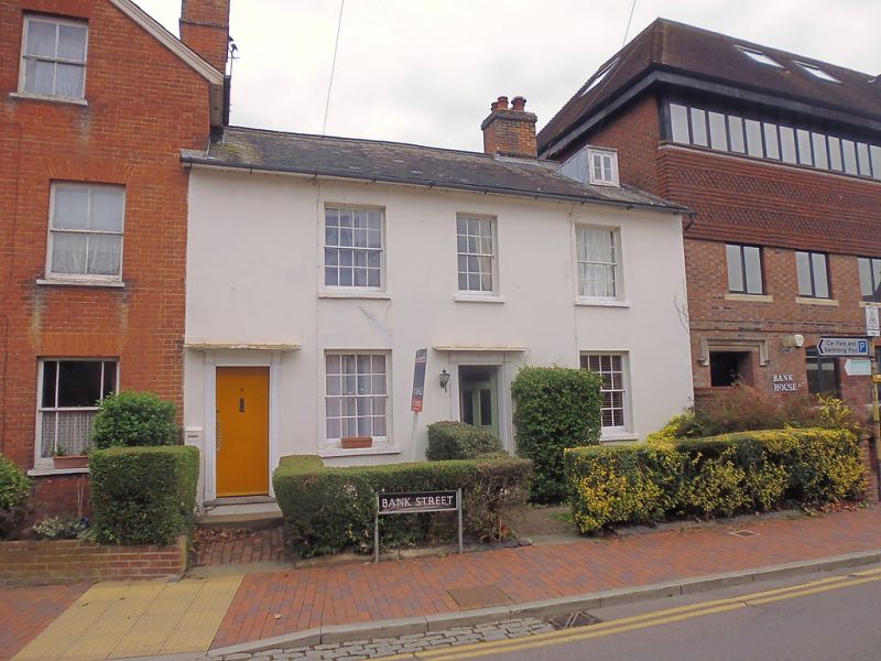
Pair of early C19 cottages, probably originally 1 house. 2 storeys, 3 windows,
stucco. Central entrance to No 9, and entrance to No 7 on extreme left side.
Reeded architraves. Glazing bars intact. Slate roof, 1 small dormer to right.
Listing NGR: TQ5899346694
External links are from the relevant listing authority and, where applicable, Wikidata. Wikidata IDs may be related buildings as well as this specific building. If you want to add or update a link, you will need to do so by editing the Wikidata entry.


Other nearby listed buildings
