Approximate Location Map
Large Map »
Latitude: 51.197 / 51°11'49"N
Longitude: 0.2751 / 0°16'30"E
OS Eastings: 559055
OS Northings: 146654
OS Grid: TQ590466
Mapcode National: GBR MP0.Y37
Mapcode Global: VHHQ6.Q58R
Plus Code: 9F3257WG+Q2
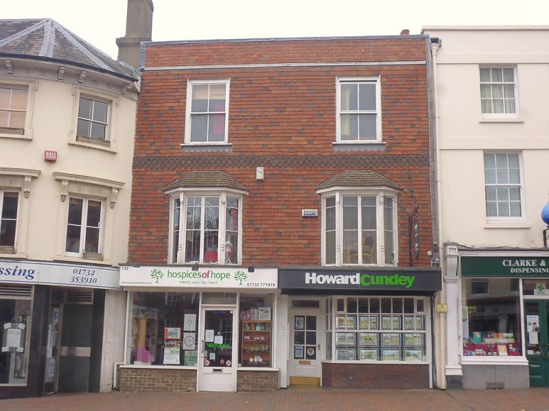
Entry Name: 136 and 138, High Street
Listing Date: 20 January 1972
Grade: II
Source: Historic England
Source ID: 1069980
English Heritage Legacy ID: 178696
ID on this website: 101069980
Location: Tonbridge, Tonbridge and Malling, Kent, TN9
County: Kent
District: Tonbridge and Malling
Electoral Ward/Division: Castle
Parish: Non Civil Parish
Built-Up Area: Tonbridge
Traditional County: Kent
Lieutenancy Area (Ceremonial County): Kent
Church of England Parish: Tonbridge St Peter and St Paul
Church of England Diocese: Rochester
Tagged with: Building
1. HIGH STREET
1732 (West Side)
Nos 136 & 138
TQ 5946 NW 3/20
II GV
2.
C18 house. 2 storeys, 4 windows. Stucco. 2 bays on 1st floor with tiled
hipped roofs. Modern shop fronts. Parapet. Tiled roof.
Nos 136 to 148 (even) including No 146a form a group
Listing NGR: TQ5905546655
External links are from the relevant listing authority and, where applicable, Wikidata. Wikidata IDs may be related buildings as well as this specific building. If you want to add or update a link, you will need to do so by editing the Wikidata entry.


Other nearby listed buildings
