Latitude: 51.2441 / 51°14'38"N
Longitude: 1.2277 / 1°13'39"E
OS Eastings: 625374
OS Northings: 154384
OS Grid: TR253543
Mapcode National: GBR VZZ.Z26
Mapcode Global: VHLGQ.7ZDN
Plus Code: 9F3366VH+J3
Entry Name: Estate Buildings About 30 Metres North of Goodnestone Park
Listing Date: 3 December 1986
Grade: II
Source: Historic England
Source ID: 1070255
English Heritage Legacy ID: 177953
ID on this website: 101070255
Location: Goodnestone, Dover, Kent, CT3
County: Kent
District: Dover
Civil Parish: Goodnestone
Traditional County: Kent
Lieutenancy Area (Ceremonial County): Kent
Tagged with: Building
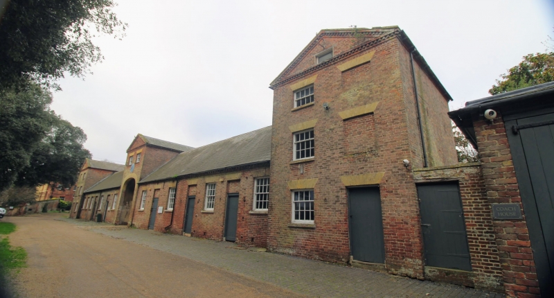
GOODNESTONE THE STREET TR 25 SE (West side) 3/92 Estate buildings about 30 metres north of Goodnestone Park GV II Estate buildings. Circa 1840 and possibly by Rickman and Hussey. Plum brick and yellow stock brick with slate roof. Three pedimented pavilions, those at end left and right of 3 storeys with 2 glazing bar sashes on each floor, some blocked in, each with boarded door on ground floor, the centre with elliptically arched gateway with 2 glazing bar sashes over. The 3 pavilions joined by single storey stable and office accommodation, with 5 glazing bar sashes to left and 2 boarded doors, and 4 glazing bar sashes and 3 boarded doors to right. The low ranges and pavilions both with brick dogtooth cornices.
Listing NGR: TR2541554411
External links are from the relevant listing authority and, where applicable, Wikidata. Wikidata IDs may be related buildings as well as this specific building. If you want to add or update a link, you will need to do so by editing the Wikidata entry.


Other nearby listed buildings