Approximate Location Map
Large Map »
Latitude: 51.067 / 51°4'1"N
Longitude: 0.6852 / 0°41'6"E
OS Eastings: 588234
OS Northings: 133171
OS Grid: TQ882331
Mapcode National: GBR QW9.02C
Mapcode Global: FRA D6B9.DRD
Plus Code: 9F323M8P+R3
Entry Name: Pittlesden Gatehouse
Listing Date: 8 April 1970
Grade: II
Source: Historic England
Source ID: 1070336
English Heritage Legacy ID: 179732
ID on this website: 101070336
Location: Tenterden, Ashford, Kent, TN30
County: Kent
District: Ashford
Civil Parish: Tenterden
Built-Up Area: Tenterden
Traditional County: Kent
Lieutenancy Area (Ceremonial County): Kent
Tagged with: Building
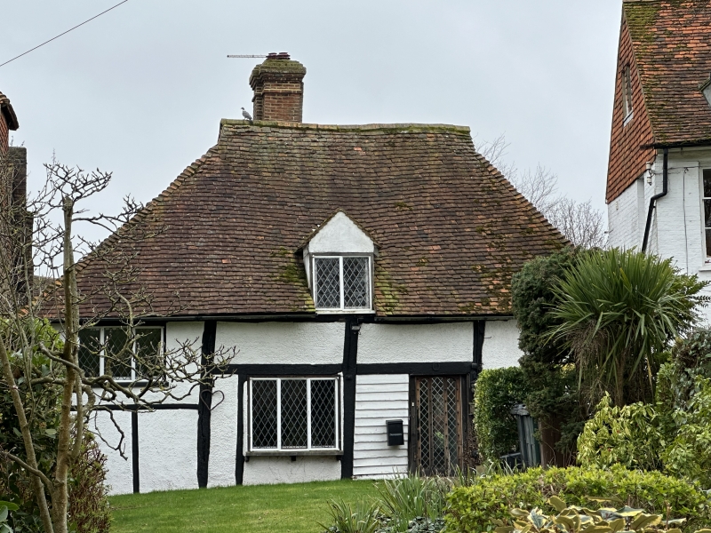
1.
1715 HIGH STREET
(South Side)
No 91
(Pittlesden Gatehouse)
TQ 8833 1/20 8.4.70.
II GV
2.
Thought to be the only remaining gatehouse of 3 belonging to a demolished
C14 mansion.
A timber-framed cottage with plaster infilling, the west end over-hanging
on the protruding ends of the floor joists and curved brackets. 2 storeys.
Half hipped roof. 2 casement windows. The interior preserves its divisions
of solar, hall and service.
Nos 79 to 117 (odd) form a group.
Listing NGR: TQ8823433169
External links are from the relevant listing authority and, where applicable, Wikidata. Wikidata IDs may be related buildings as well as this specific building. If you want to add or update a link, you will need to do so by editing the Wikidata entry.


Other nearby listed buildings
