Latitude: 51.2316 / 51°13'53"N
Longitude: 0.2137 / 0°12'49"E
OS Eastings: 554653
OS Northings: 150379
OS Grid: TQ546503
Mapcode National: GBR MNK.LW2
Mapcode Global: VHHPZ.N9BN
Plus Code: 9F3266J7+MF
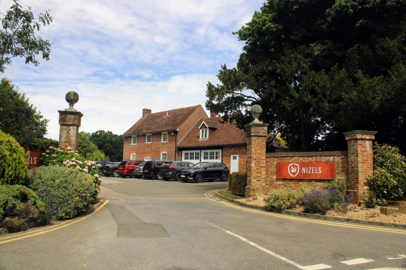
Entry Name: Gate Piers, Gate and Flanking Walls to the Drive to Nizels House
Listing Date: 19 February 1990
Grade: II
Source: Historic England
Source ID: 1070403
English Heritage Legacy ID: 179598
ID on this website: 101070403
Location: Tonbridge and Malling, Kent, TN11
County: Kent
District: Tonbridge and Malling
Civil Parish: Hildenborough
Traditional County: Kent
Lieutenancy Area (Ceremonial County): Kent
Church of England Parish: Hildenborough St John the Evangelist
Church of England Diocese: Rochester
Tagged with: Gatepost
HILDENBOROUGH NIZELS LANE (west side) TQ 55 SW 1/165 Gate piers, gate and flanking - walls at the entrance to the drive to Nizels House GV II
Gate piers, gate and flanking walls. Early C20. Brick walls, brick and stone piers, timber gate.
Adjacent to the Lodge, Nizels, and probably contemporary with the remodelling of Nizels House (q.v.) and the layout of the Edwardian garden.
Square section gate piers with plinths and moulded stone cornices, crowned with ball finials. The stout timber gate with diagonal cross-bracing is hung from a chamfered timber post with a ramshorn moulding below the finial. Short sections of curved brick wall extend from the gate piers to shorter piers at either end.
Although fairly plain in design the gateway is probably part of the Edwardian programme of work at Nizels House.
Group value with the Lodge, Nizels.
Listing NGR: TQ5467849570
External links are from the relevant listing authority and, where applicable, Wikidata. Wikidata IDs may be related buildings as well as this specific building. If you want to add or update a link, you will need to do so by editing the Wikidata entry.


Other nearby listed buildings