Latitude: 51.0918 / 51°5'30"N
Longitude: 0.7597 / 0°45'34"E
OS Eastings: 593351
OS Northings: 136120
OS Grid: TQ933361
Mapcode National: GBR RXB.DWY
Mapcode Global: FRA D6G7.KSS
Plus Code: 9F323QR5+PV
Entry Name: Apple Field
Listing Date: 9 August 1979
Grade: II
Source: Historic England
Source ID: 1070839
English Heritage Legacy ID: 180560
ID on this website: 101070839
Location: Ashford, Kent, TN26
County: Kent
District: Ashford
Civil Parish: Woodchurch
Traditional County: Kent
Lieutenancy Area (Ceremonial County): Kent
Tagged with: Building
WOODCHURCH REDBROOK STREET 1. 5272 Apple Field TQ 93 NW 5/538 II
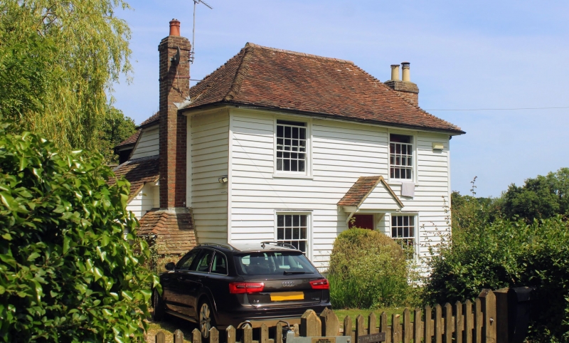
2. C18 front to an older cottage. Two storeys faced with weatherboarding. Hipped tiled roof. Two sashes with glazing bars intact. Doorcase with flat hood over on brackets and door of 6 moulded panels. Brick chimney breast with offsets on the east wall.
Listing NGR: TQ9335136120
External links are from the relevant listing authority and, where applicable, Wikidata. Wikidata IDs may be related buildings as well as this specific building. If you want to add or update a link, you will need to do so by editing the Wikidata entry.


Other nearby listed buildings