Latitude: 51.0922 / 51°5'31"N
Longitude: 0.7591 / 0°45'32"E
OS Eastings: 593308
OS Northings: 136160
OS Grid: TQ933361
Mapcode National: GBR RXB.DRF
Mapcode Global: FRA D6G7.KJY
Plus Code: 9F323QR5+VJ
Entry Name: Beales Farmhouse
Listing Date: 9 August 1979
Grade: II
Source: Historic England
Source ID: 1337679
English Heritage Legacy ID: 180561
ID on this website: 101337679
Location: Ashford, Kent, TN26
County: Kent
District: Ashford
Civil Parish: Woodchurch
Traditional County: Kent
Lieutenancy Area (Ceremonial County): Kent
Tagged with: Farmhouse
WOODCHURCH REDBROOK STREET 1. 5272 Beales Farmhouse TQ 93 NW 5/539 II
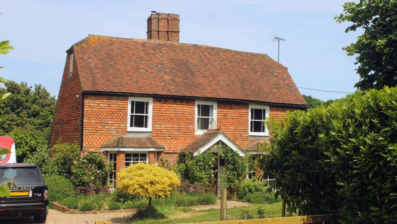
2. Probably C16. Timber framed house refaced in C18. Two storeys. Ground floor red brick, first floor tile hung. Half hipped tiled roof with C17 brick chimney stack. Casement windows. Interior contains exposed beams and inglenook fireplace.
Listing NGR: TQ9330936158
External links are from the relevant listing authority and, where applicable, Wikidata. Wikidata IDs may be related buildings as well as this specific building. If you want to add or update a link, you will need to do so by editing the Wikidata entry.


Other nearby listed buildings