Approximate Location Map
Large Map »
Latitude: 51.0516 / 51°3'5"N
Longitude: 0.6301 / 0°37'48"E
OS Eastings: 584436
OS Northings: 131316
OS Grid: TQ844313
Mapcode National: GBR QW6.XTS
Mapcode Global: FRA D66B.P96
Plus Code: 9F323J2J+J2
Entry Name: Streyte Cottage
Listing Date: 9 August 1979
Grade: II
Source: Historic England
Source ID: 1070918
English Heritage Legacy ID: 180333
ID on this website: 101070918
Location: Rolvenden, Ashford, Kent, TN17
County: Kent
District: Ashford
Civil Parish: Rolvenden
Built-Up Area: Rolvenden
Traditional County: Kent
Lieutenancy Area (Ceremonial County): Kent
Tagged with: Cottage
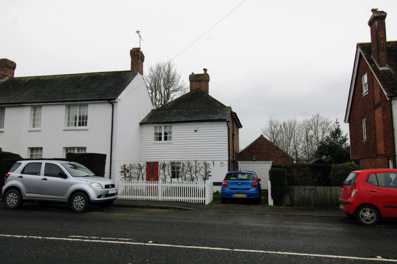
ROLVENDEN HIGH STREET
1.
5272
(west side)
No 10
(Streyte Cottage)
TW Q 8431 18/289
II GV
2.
fc
Mid C19. Two storeys. Ground floor painted brick, first floor, weatherboarded.
Slate roof. One casement. Simple doorcase.
Listing NGR: TQ8443631316
External links are from the relevant listing authority and, where applicable, Wikidata. Wikidata IDs may be related buildings as well as this specific building. If you want to add or update a link, you will need to do so by editing the Wikidata entry.


Other nearby listed buildings
