Approximate Location Map
Large Map »
Latitude: 51.0519 / 51°3'7"N
Longitude: 0.6299 / 0°37'47"E
OS Eastings: 584422
OS Northings: 131357
OS Grid: TQ844313
Mapcode National: GBR QW6.XSC
Mapcode Global: FRA D66B.P6V
Plus Code: 9F323J2H+QX
Entry Name: 20, High Street
Listing Date: 9 August 1979
Grade: II
Source: Historic England
Source ID: 1070919
English Heritage Legacy ID: 180335
ID on this website: 101070919
Location: Rolvenden, Ashford, Kent, TN17
County: Kent
District: Ashford
Civil Parish: Rolvenden
Built-Up Area: Rolvenden
Traditional County: Kent
Lieutenancy Area (Ceremonial County): Kent
Tagged with: Building
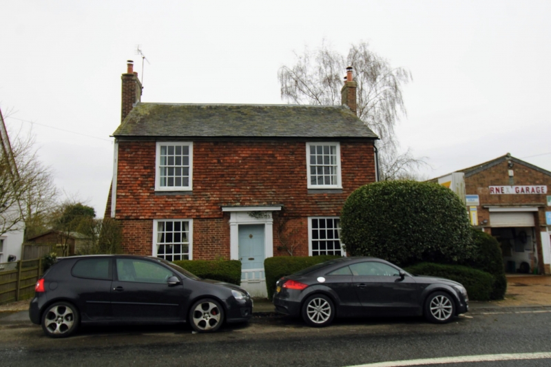
ROLVENDEN HIGH STREET
1.
5272 (west side)
No 20
TQ 8431 18/291
II GV
2.
C18 exterior to a probably older building. Two storeys. Ground floor red
brick, above tile hung. Slate roof. Two sashes with glazing bars intact.
Doorcase with fluted pilasters, projecting cornice and door of 6 fielded panels.
Brick chimney breast on south wall.
Listing NGR: TQ8442031356
External links are from the relevant listing authority and, where applicable, Wikidata. Wikidata IDs may be related buildings as well as this specific building. If you want to add or update a link, you will need to do so by editing the Wikidata entry.


Other nearby listed buildings
