Latitude: 51.1487 / 51°8'55"N
Longitude: 0.8744 / 0°52'27"E
OS Eastings: 601134
OS Northings: 142755
OS Grid: TR011427
Mapcode National: GBR RWP.ZVL
Mapcode Global: VHKKN.3DM7
Plus Code: 9F324VXF+FQ
Entry Name: 19A, HIGH STREET (See details for further address information)
Listing Date: 4 June 1976
Grade: II
Source: Historic England
Source ID: 1071085
English Heritage Legacy ID: 179930
ID on this website: 101071085
Location: Ashford, Kent, TN24
County: Kent
District: Ashford
Electoral Ward/Division: Victoria
Parish: Non Civil Parish
Built-Up Area: Ashford (Ashford)
Traditional County: Kent
Lieutenancy Area (Ceremonial County): Kent
Tagged with: Building
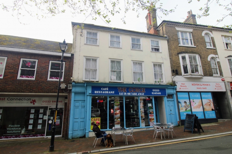
1. 5344 HIGH STREET (South Side) No 19 No 19A TR 0142 NW 1/3 II GV 2. Early C19. 2 parallel ranges. 3 storeys stuccoed. Hipped tiled roof and wooden modillion eaves cornice. Rain water head. 4 sashes with moulded architraves and verticals only. C19 shop front flanked by doorways with rectangular fanlights and doors of 6 moulded panels.
Nos 19, 19A, 21 to 25 (odd), 25A, 27, 31 and 31A form a group.
Listing NGR: TR0113442755
External links are from the relevant listing authority and, where applicable, Wikidata. Wikidata IDs may be related buildings as well as this specific building. If you want to add or update a link, you will need to do so by editing the Wikidata entry.


Other nearby listed buildings