Approximate Location Map
Large Map »
Latitude: 51.0444 / 51°2'39"N
Longitude: 0.7381 / 0°44'17"E
OS Eastings: 592037
OS Northings: 130796
OS Grid: TQ920307
Mapcode National: GBR RXW.FFH
Mapcode Global: FRA D6FC.9D7
Plus Code: 9F322PVQ+Q7
Entry Name: Ramsden Farmhouse
Listing Date: 8 May 1950
Grade: II
Source: Historic England
Source ID: 1071152
English Heritage Legacy ID: 179794
ID on this website: 101071152
Location: Reading Street, Ashford, Kent, TN30
County: Kent
District: Ashford
Civil Parish: Tenterden
Traditional County: Kent
Lieutenancy Area (Ceremonial County): Kent
Tagged with: Farmhouse
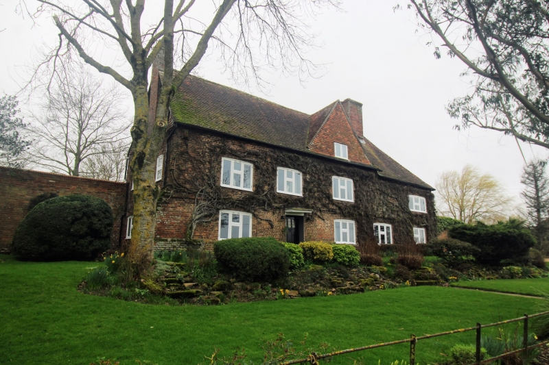
1.
1715 READING STREET
(South West Side)
Ramsden Farmhouse
TQ 93 SW 6/147 8.5.50.
II GV
2.
C17. 2 storeys and attics red brick. Tile-hung gable in the centre with
2nd floor window in it. Stringcourse above ground floor. 4 casement
windows. Doorcase with flat hood over.
Ramdsen Farmhouse and Barn form a group.
Listing NGR: TQ9203730796
External links are from the relevant listing authority and, where applicable, Wikidata. Wikidata IDs may be related buildings as well as this specific building. If you want to add or update a link, you will need to do so by editing the Wikidata entry.


Other nearby listed buildings
