Latitude: 51.1471 / 51°8'49"N
Longitude: 0.708 / 0°42'28"E
OS Eastings: 589507
OS Northings: 142140
OS Grid: TQ895421
Mapcode National: GBR QVB.5T9
Mapcode Global: VHKKK.7F5G
Plus Code: 9F324PW5+V6
Entry Name: Romden
Listing Date: 14 February 1967
Last Amended: 10 October 1980
Grade: II
Source: Historic England
Source ID: 1071348
English Heritage Legacy ID: 181234
ID on this website: 101071348
Location: Biddenden Green, Ashford, Kent, TN27
County: Kent
District: Ashford
Civil Parish: Smarden
Traditional County: Kent
Lieutenancy Area (Ceremonial County): Kent
Tagged with: Building
1. 5272 SMARDEN ROMDEN ROAD Romden (formerly listed as Little Romden) TQ 8942 29/43
II
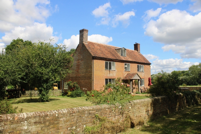
2. C18 L-shaped house. Two storeys and attics red brick. Tiled roof with gabled dormer. three casement windows with small square leaded panes. Doorcase in moulded architrave surround with door of 6 fielded panels and a modern porch built over it.
Listing NGR: TQ8950742140
External links are from the relevant listing authority and, where applicable, Wikidata. Wikidata IDs may be related buildings as well as this specific building. If you want to add or update a link, you will need to do so by editing the Wikidata entry.


Other nearby listed buildings