Approximate Location Map
Large Map »
Latitude: 51.1746 / 51°10'28"N
Longitude: 0.7545 / 0°45'16"E
OS Eastings: 592643
OS Northings: 145308
OS Grid: TQ926453
Mapcode National: GBR RWB.CL3
Mapcode Global: VHKKD.1Q7Y
Plus Code: 9F325QF3+RR
Entry Name: Fir Tree Cottage
Listing Date: 10 October 1980
Grade: II
Source: Historic England
Source ID: 1071389
English Heritage Legacy ID: 181131
ID on this website: 101071389
Location: Pluckley, Ashford, Kent, TN27
County: Kent
District: Ashford
Civil Parish: Pluckley
Built-Up Area: Pluckley Thorne
Traditional County: Kent
Lieutenancy Area (Ceremonial County): Kent
Tagged with: Cottage
1.
5272 PLUCKLEY THE STREET
(south-west side)
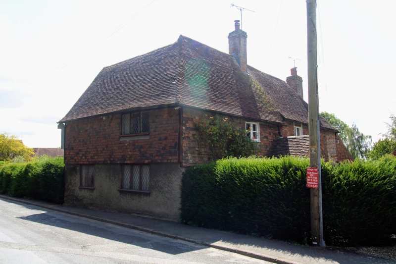
Fir Tree Cottage
TQ 9245 27/8
II GV
2.
Probably C17. Two storeys. Ground floor roughcast, above tile-hung. Hipped tiled roof
with pentice behind. Sprocket eaves. Four casement windows.
Listing NGR: TQ9264345308
External links are from the relevant listing authority and, where applicable, Wikidata. Wikidata IDs may be related buildings as well as this specific building. If you want to add or update a link, you will need to do so by editing the Wikidata entry.


Other nearby listed buildings
