Latitude: 51.1741 / 51°10'26"N
Longitude: 0.7556 / 0°45'20"E
OS Eastings: 592723
OS Northings: 145259
OS Grid: TQ927452
Mapcode National: GBR RWB.CTY
Mapcode Global: VHKKD.1RT9
Plus Code: 9F325QF4+J7
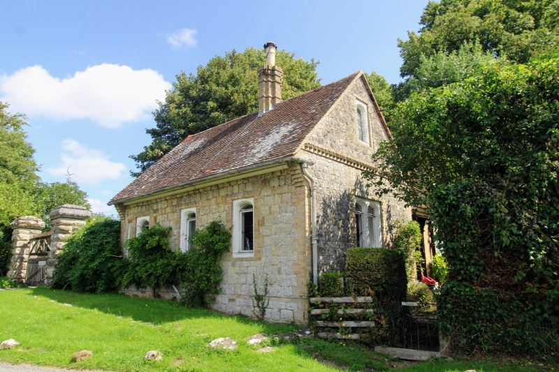
Entry Name: Gate Lodge to Former Surrenden Dering, 300 Metres to South East of Church of St Nicholas, Pluckley
Listing Date: 10 October 1980
Grade: II
Source: Historic England
Source ID: 1071423
English Heritage Legacy ID: 181108
ID on this website: 101071423
Location: Pluckley, Ashford, Kent, TN27
County: Kent
District: Ashford
Civil Parish: Pluckley
Built-Up Area: Pluckley Thorne
Traditional County: Kent
Lieutenancy Area (Ceremonial County): Kent
Tagged with: Gatehouse
1. 5272 PLUCKLEY PLUCKLEY Gate Lodge to former Surrenden Dering, 300 metres to south-east of Church of St. Nicholas, Pluckley TQ 9245 27/46 II 2. Mid C19 lodge building. One storey and attics squared ragstone set endwise to tile road. Tiled roof with clustered brick stack. Gable end with brick crow-stepped kneelers and quoins and stringcourse of bricks set diagonally. Blank attic mullion with moulded brick surround. The ground floor has a double stone mullioned window, the hallmark of property which was attached to Surrenden Wooden doorcase.
Listing NGR: TQ9272345259
External links are from the relevant listing authority and, where applicable, Wikidata. Wikidata IDs may be related buildings as well as this specific building. If you want to add or update a link, you will need to do so by editing the Wikidata entry.


Other nearby listed buildings