Latitude: 51.1376 / 51°8'15"N
Longitude: 0.8222 / 0°49'20"E
OS Eastings: 597533
OS Northings: 141381
OS Grid: TQ975413
Mapcode National: GBR RWT.QNZ
Mapcode Global: VHKKM.6NJR
Plus Code: 9F324RQC+2V
Entry Name: Little Moat Farmhouse
Listing Date: 10 October 1980
Grade: II
Source: Historic England
Source ID: 1071502
English Heritage Legacy ID: 180892
ID on this website: 101071502
Location: Chilmington Green, Ashford, Kent, TN23
County: Kent
District: Ashford
Civil Parish: Great Chart with Singleton
Traditional County: Kent
Lieutenancy Area (Ceremonial County): Kent
Tagged with: Farmhouse
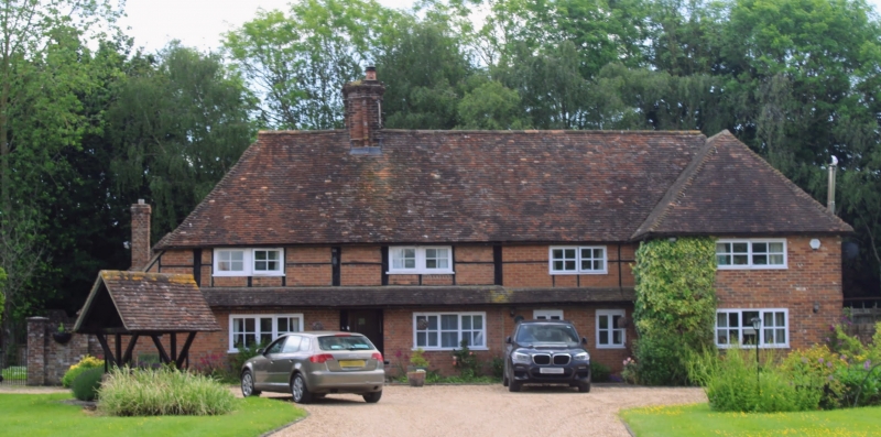
1.
5272 GREAT CHART ASHFORD ROAD
Little Moat Farmhouse
TQ 9741 24/50
II
2.
C17 or earlier timber-framed building with the timber-framing visible on the
first floor. Mainly 2 storeys red brick. Hipped tiled roof. Two casement
windows to the first floor, 2 to ground floor. Simple doorcase with flat wooden
weatherhood.
Listing NGR: TQ9753341381
External links are from the relevant listing authority and, where applicable, Wikidata. Wikidata IDs may be related buildings as well as this specific building. If you want to add or update a link, you will need to do so by editing the Wikidata entry.


Other nearby listed buildings