Approximate Location Map
Large Map »
Latitude: 54.0174 / 54°1'2"N
Longitude: -2.7858 / 2°47'8"W
OS Eastings: 348611
OS Northings: 458214
OS Grid: SD486582
Mapcode National: GBR 8PZZ.PM
Mapcode Global: WH84F.59Q1
Plus Code: 9C6V2687+WM
Entry Name: Bailrigg Farmhouse
Listing Date: 7 March 1985
Grade: II
Source: Historic England
Source ID: 1071754
English Heritage Legacy ID: 182250
ID on this website: 101071754
Location: Bailrigg, Lancaster, Lancashire, LA1
County: Lancashire
District: Lancaster
Civil Parish: Scotforth
Traditional County: Lancashire
Lieutenancy Area (Ceremonial County): Lancashire
Church of England Parish: Lancaster St Paul
Church of England Diocese: Blackburn
Tagged with: Farmhouse
SD 45 NE SCOTFORTH
8/186 Bailrigg Farmhouse
-
- II
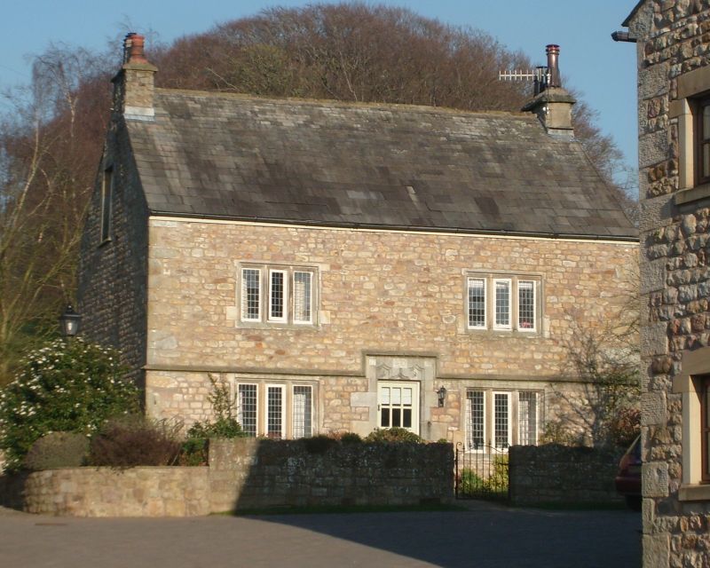
House, 1718. Slobbered sandstone rubble with slate roof. Double-pile plan.
2 storeys with attic, 2 bays. Windows of 3 lights, rebated and chamfered with
mullions. Those on ground floor have probably had their sills lowered. Drip
course rises over the central doorway which has a moulded surround and a
shaped lintel with date '1718' and initials partly covered by modern light
fitting. At the rear is a stair window with 2 transoms, the middle light
blocked.
Listing NGR: SD4861158214
External links are from the relevant listing authority and, where applicable, Wikidata. Wikidata IDs may be related buildings as well as this specific building. If you want to add or update a link, you will need to do so by editing the Wikidata entry.


Other nearby listed buildings
