Latitude: 53.4034 / 53°24'12"N
Longitude: -2.9539 / 2°57'14"W
OS Eastings: 336674
OS Northings: 390039
OS Grid: SJ366900
Mapcode National: GBR 7CP.0Z
Mapcode Global: WH877.LQK8
Plus Code: 9C5VC23W+8C
Entry Name: Presbytery to Church of Saint Anne
Listing Date: 19 June 1985
Grade: II
Source: Historic England
Source ID: 1072984
English Heritage Legacy ID: 359208
ID on this website: 101072984
Location: Edge Hill, Liverpool, Merseyside, L7
County: Liverpool
Electoral Ward/Division: Picton
Parish: Non Civil Parish
Built-Up Area: Liverpool
Traditional County: Lancashire
Lieutenancy Area (Ceremonial County): Merseyside
Church of England Parish: St Luke in the City Team
Church of England Diocese: Liverpool
Tagged with: Clergy house
SJ 3690 OVERBURY STREET L7
28/867 Presbytery to church of Saint - Anne
G.V. II
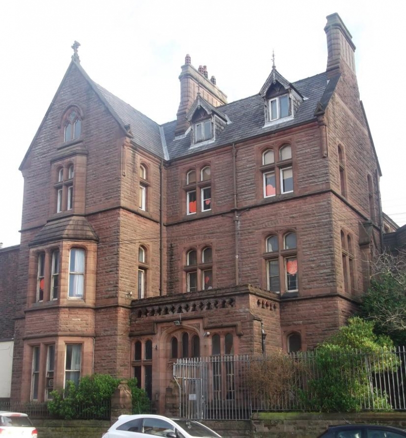
Presbytery. Probably 1888-9. Pugin and Pugin.Rock faced stone with ashlar dressings, slate roof. 3 storeys with attic, 3 bays; 1st bay projects under gable with one bay return. Weathered sill bands and top cornice. Cross windows, and 1st bay 2-storey canted oriel with projecting window above and 2 light pointed window in gable. 2 timber roof dormers. Enclosed porch with pierced parapet. Entrance has 4 centred head with 3 light fanlight and flanking cross windows. Right return has buttresses with canopied niches and end stack, 2-storey connecting block with canted oriel and projecting baptistry with straight-headed window of 3 lights with reticulated tracery joins this item to St Anne's church (q.v.).
Listing NGR: SJ3667490039
External links are from the relevant listing authority and, where applicable, Wikidata. Wikidata IDs may be related buildings as well as this specific building. If you want to add or update a link, you will need to do so by editing the Wikidata entry.


Other nearby listed buildings