Approximate Location Map
Large Map »
Latitude: 53.8548 / 53°51'17"N
Longitude: -2.8757 / 2°52'32"W
OS Eastings: 342493
OS Northings: 440191
OS Grid: SD424401
Mapcode National: GBR 8RCV.6X
Mapcode Global: WH854.SCSQ
Plus Code: 9C5VV43F+WP
Entry Name: Pinfold
Listing Date: 3 October 1984
Grade: II
Source: Historic England
Source ID: 1073068
English Heritage Legacy ID: 185017
ID on this website: 101073068
Location: Great Eccleston, Wyre, Lancashire, PR3
County: Lancashire
District: Wyre
Civil Parish: Great Eccleston
Built-Up Area: Great Eccleston
Traditional County: Lancashire
Lieutenancy Area (Ceremonial County): Lancashire
Church of England Parish: Copp or Great Eccleston St Anne
Church of England Diocese: Blackburn
Tagged with: Animal pound
SD 44 SW GREAT ECCLESTON HIGH STREET
(South Side)
5/5 Pinfold
-
- II
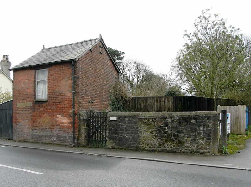
Pound, probably C19th. Sandstone rubble. Roughly trapezoidal on plan,
with entrance on north side and with walls about 2 metres high, some with
rounded copings, some with triangular copings.
Listing NGR: SD4249340191
External links are from the relevant listing authority and, where applicable, Wikidata. Wikidata IDs may be related buildings as well as this specific building. If you want to add or update a link, you will need to do so by editing the Wikidata entry.


Other nearby listed buildings
