Latitude: 53.8628 / 53°51'45"N
Longitude: -2.8197 / 2°49'11"W
OS Eastings: 346185
OS Northings: 441039
OS Grid: SD461410
Mapcode National: GBR 8RRS.B1
Mapcode Global: WH855.N5GK
Plus Code: 9C5VV57J+44
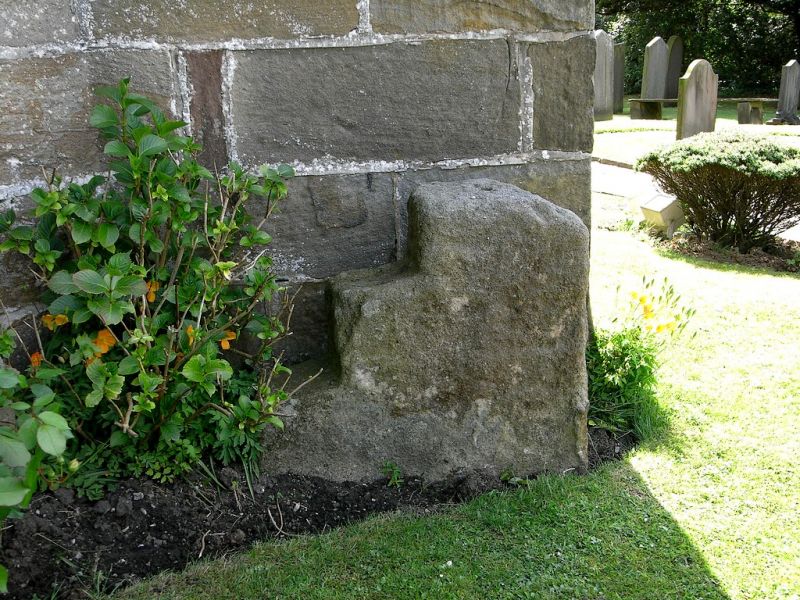
Entry Name: Mounting Block Adjoining South Western Tower Buttress, Church of St Michael
Listing Date: 3 October 1984
Grade: II
Source: Historic England
Source ID: 1073087
English Heritage Legacy ID: 185049
ID on this website: 101073087
Location: St Michael's Church, St Michael's on Wyre, Wyre, Lancashire, PR3
County: Lancashire
District: Wyre
Civil Parish: Upper Rawcliffe-with-Tarnacre
Built-Up Area: St Michael's on Wyre
Traditional County: Lancashire
Lieutenancy Area (Ceremonial County): Lancashire
Tagged with: Building
SD 44 SE UPPER RAWCLIFFE-WITH-TARNACRE GARSTANG ROAD
6/37 Mounting block
adjoining south-western
tower buttress, Church
of St. Michael
-
GV II
Mounting block, possibly C18th. Sandstone. A single block of stone, cut with 3
steps.
Listing NGR: SD4618641046
External links are from the relevant listing authority and, where applicable, Wikidata. Wikidata IDs may be related buildings as well as this specific building. If you want to add or update a link, you will need to do so by editing the Wikidata entry.


Other nearby listed buildings