Approximate Location Map
Large Map »
Latitude: 52.6588 / 52°39'31"N
Longitude: -0.6699 / 0°40'11"W
OS Eastings: 490060
OS Northings: 307619
OS Grid: SK900076
Mapcode National: GBR DT5.CFQ
Mapcode Global: WHGLT.PF5J
Plus Code: 9C4XM85J+G2
Entry Name: Manor Farmhouse
Listing Date: 18 September 1984
Grade: II
Source: Historic England
Source ID: 1073720
English Heritage Legacy ID: 187406
ID on this website: 101073720
Location: Upper Hambleton, Rutland, LE15
County: Rutland
Civil Parish: Hambleton
Traditional County: Rutland
Lieutenancy Area (Ceremonial County): Rutland
Church of England Parish: Hambleton
Church of England Diocese: Peterborough
Tagged with: Farmhouse Thatched farmhouse
SK 90 NW HAMBLETON
8/120 Manor Farmhouse
GV II
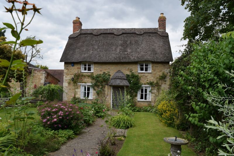
Cottage, C18. Coursed rubble with thatched roof and brick gable end
stacks. 2 storeys, 2 unit plan with central door. 2-light casement
windows with flat timber lintels.
Listing NGR: SK9006007619
External links are from the relevant listing authority and, where applicable, Wikidata. Wikidata IDs may be related buildings as well as this specific building. If you want to add or update a link, you will need to do so by editing the Wikidata entry.


Other nearby listed buildings
